Improving Risk Indicators: Introducing the Next Generation Drought Index Project
Across the globe, food security continues to be a significant challenge, one that is estimated to increase with the compounding factors of the COVID-19 pandemic and climate change. The Next Generation Drought Index (NGDI) project addresses this challenge by leveraging satellite technology and drought modeling to provide humanitarian and development agencies access to the latest and most reliable drought risk information for better planning and action to alleviate the effects of drought.
The World Bank’s Disaster Risk Financing and Insurance Program (DRFIP) led the development of the NGDI platform in close partnership with the European Space Agency’s Center for Earth Observation (ESA/ESRIN). The International Research Institute for Climate and Society (IRI) provided technical support, leading a consortium including partners from the finance analytics company AIR Worldwide and the International Water Management Institute (IMWI) to develop a participatory tool for cogeneration and evaluation of new satellite datasets and insurance solutions.
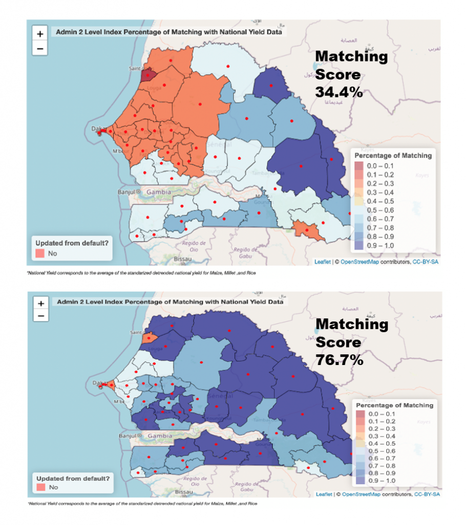
“The NGDI platform provides tailored climate information along with performance metrics against vulnerability information to enable users to understand and lead the design of risk financing products such as index insurance,” said Rahel Diro, a senior staff associate and member of the IRI’s Financial Instruments Sector team.
The Adapting Agriculture to Climate Today, for Tomorrow (ACToday) Columbia World Project supported the development of NGDI and is using the new platform as part of its efforts in Senegal to build a new approach to for large scale, sustainable projects with local partners having ownership of using new satellite technologies to address farmers’ needs.
Read more about the Next Generation Drought Index project here.
Learn more about the training process for NGDI here.
Check out the tool here. (Access the tool with the username WB and password IRI.)
You must be logged in to post a comment.