Was it a flash flood or not? Categorizing disaster types in historical records
IRI researchers develop new methods to assess flash flood risk to support anticipatory humanitarian action
One of the important applications of climate knowledge is in the area of disasters. Being able to predict the scale of a potential disaster and the risks a disaster could impose on a community in the future is valuable and crucial information for not just government agencies and aid organizations, but also to support individuals and communities to both build strategies to become more resilient, and to anticipate when a disaster is likely to occur.
Disasters can differ widely based on region, climate, time of year, socioeconomic context, and other factors. However, while we have seen significant advances in understanding risk for some disaster types, such as drought and hurricanes, progress has lagged behind for other types – such as floods and particularly flash floods. While floods differ based on the water source and land area, it is generally recognized that flash floods can be especially dangerous.
Andrew Kruczkiewicz, Agathe Bucherie, Simon Mason, and their colleagues have delved into these definitions for a recent paper titled “Development of a Flash Flood Confidence Index from Disaster Reports and Geophysical Susceptibility.” We asked Agathe and Andrew for their insight into this intersection of climate data and application.
Some people might see dividing floods into different types as splitting hairs, but it’s true that a “coastal” flood is very different in many ways from a “flash” flood. Why do you think these distinctions are crucial? Why do we need to categorize disasters?
Agathe Bucherie: Not all floods are the same. They can have different root causes and behaviour, leading to very different impacts. Understanding and categorizing floods according to their triggers is key to improving disaster predictions. Indeed, techniques used for coastal flood forecasting (for instance based on storm surge models) differ significantly from riverine flood forecasting (commonly using large scale hydrological network monitoring) or flash flood forecasting (primarily based on local and extreme precipitation forecast). Furthermore, flood risk differs significantly in time and space from one flood type to another. Mapping accurately where and when populations are more likely to be affected by each type of flood is crucial to improve disaster risk perception. Unfortunately, some disasters like flash floods remain neglected, and some communities in highlands, far from commonly mapped flood prone areas such as coastal or floodplains, might feel safe and not be aware of the flash flood risk. Floods have very different behaviour, and knowing which type of flood communities are exposed to is crucial for disaster practitioners to anticipate what type of impact to expect. For instance, flash floods, characterized by localized and suddenly devastating events, are the most damaging and deadly flood type globally. Appropriate disaster preparedness and response actions might therefore differ from one flood type to the other.
What’s the history of this work at the International Research Institute for Climate and Society?
Andrew Kruczkiewicz: IRI has been one of the leaders in climate research generally for nearly three decades, and has applied that research to disasters for the past 20 years. For example, more than a decade ago the institute published a report on how advances in climate and weather forecasting should (and shouldn’t) be integrated into disaster-risk management policy and practice. Since then, various activities have evolved here at IRI, with key collaborations from our work with the Red Cross, World Food Programme, World Bank and Group on Earth Observations. Over the past five to ten years, the humanitarian and development communities have begun to develop more structured approaches to incorporate forecast and risk based strategies within their standard operating procedures. However, destructive, rapid-onset extreme events such as flash floods and mudflows have remained elusive in terms of moving beyond ‘once-off’ projects.
Our work on flash floods was jump-started by a four-year NASA grant to work in collaboration with the IFRC Climate Centre and Ecuadorian Red Cross to co-develop a new impact-based forecast for flash flood. That project also supported the design of an ‘early action protocol’ so that the Red Cross could align the forecast with a replenishable source of funding for early action to be taken.
Recently, IRI’s disaster work has led to collaboration across Columbia University, including with a new disasters and resilience network through which the Climate School will be developing additional activities related to the science, policy and practice of disasters.
Additional collaborations with Ecuador’s National Meteorological Institute (INAMHI), the NOAA Cooperative Institute for Severe and High-Impact Weather Research, and the Climate School’s Center for International Earth Science Information Network has supported IRI’s work in this interdisciplinary space.
How has the inclusion of remote sensing data improved our understanding of floods and flood risk?
Agathe: Remote sensing techniques are increasingly used to analyze the spatial and temporal distribution of flood risk globally, especially to characterize flood hazard and exposure. One of the most common applications is the use of Synthetic Aperture Radar (SAR) imagery to monitor current and detect past inundated areas, and assess structural flood impacts. However, the detection of flash flood events remains a challenge using Earth Observation. While remote sensing is useful to map areas exposed to flood risk based on historical flood frequency, we are particularly interested in integrating remote sensing to analyze the flash flood susceptibility of a watershed, in case of heavy rain. We use Digital Elevation Model, Land Use Land Cover and Sand content product derived from remote sensing techniques to extract catchment geomorphology and surface characteristics, indicating increased flash flood potential. In addition, we explore the benefit of using remote sensing for the assessment of structural vulnerability, with a pilot project in the urban area of Quito, Ecuador. Using Google Street View, we designed a process that allows us to build training datasets to automate the mapping of flood vulnerability for urban areas in geographic regions. This was developed in collaboration with Lehman College City University of New York led by graduate students Raychell Velez, Diana Calderon and Lauren Carey and Carolynne Hultquist at CIESIN, published here.
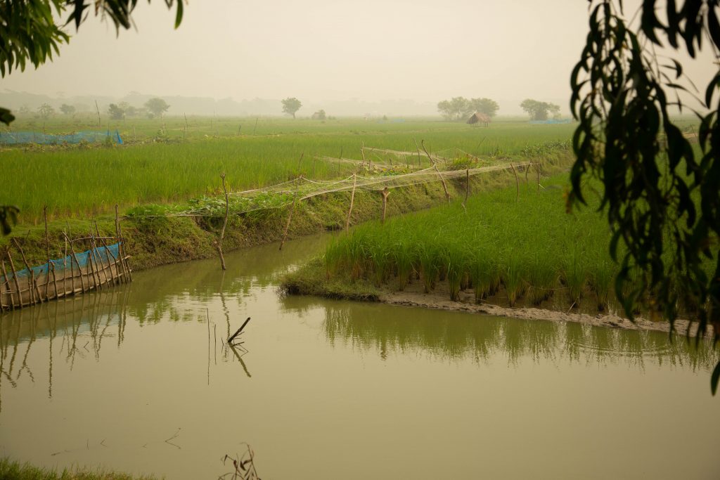
Photo credit Jacquelyn Turner, IRI.
How do you hope policymakers use this study?
Andrew: The overarching goal is to produce an Early Action Protocol (EAP) for flash floods by integrating this study with static and dynamic information on flash flood hazard, exposure and social vulnerability in Ecuador. However, doing so is a process that necessitates engagement with decision makers from the earliest stages of the project. One of the most promising elements of this project is that from the earliest design stages, policy development has been an equal, if not greater, motivating factor. While there are various early warning systems for disasters, including for floods and flash floods, there are few systems that integrate early action within the warning. There are even fewer that align structured, replenishable funding sources with the action. While it is challenging to balance the pursuit of rigorous science with the urgent need to produce a ‘usable output’, we strive to ensure that expectations are matched across each partner organizations, donors, and collaborating scientists, so that the constraints and opportunities–as well as the timeline for various types of outputs (not limited to data outputs)–are communicated.
Given that our work is focused on developing anticipatory action plans specifically for the humanitarian sector, we need to keep in mind the ethical considerations and tradeoffs between developing rapid, project-based outputs that may be short-lived, and spending additional resources to develop policy responses and standard operating procedures that will take longer to do but will likely last beyond any project’s lifecycle. This balance is difficult and asks for scientists to step outside of their comfort zone. However, at IRI we understand the importance of being clear about the privilege and responsibility that comes with working in the disaster community, especially within the humanitarian sector. In many cases, challenges in anticipating disasters may seem to be a ‘data’ problem. But even if that is the case, data is not necessarily the solution, and many times data is not the primary issue. The more significant challenges are in getting existing data integrated within policy and community action.
You must be logged in to post a comment.