Crop Models to Integrate Data from Space with Climate Forecasts

IRI Research Scientist Amor Ines.
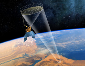
In a few months, NASA will launch a new satellite mission called Soil Moisture Active Passive, SMAP, which will provide high-resolution global coverage of soil moisture conditions. The International Research Institute for Climate and Society is collaborating with NASA’s Jet Propulsion Laboratory and the CGIAR’s Research Program on Climate Change, Agriculture and Food Security to develop a crop-forecasting model to help decision makers in the agricultural sector better plan for crop growth.
We sat down with research scientist Amor Ines to learn more about IRI’s role in NASA’s SMAP mission. Ines specializes in remote sensing and climate-based crop modeling to enhance decision-making in agriculture and water management.
What is SMAP and how is your project using it to improve crop forecasting?
Ines: SMAP is a new NASA satellite mission that will provide global measurement of soil moisture at a higher resolution than what currently exists. In collaboration with NASA’s Jet Propulsion Laboratory and CCAFS, IRI is developing a crop forecasting methodology capable of using SMAP soil moisture data to improve the simulation of soil moisture dynamics in agricultural crop models.
One objective of SMAP is to improve the accuracy and lead-time of soil moisture monitoring and predictions to help decision-makers in the agricultural sector better plan their cropping activities. By incorporating SMAP data into our model, we expect improved ability to predict crop yields.
Why is such a technology needed and who will benefit from it?
The SMAP spacecraft. (NASA)
Ines: Depending on the scale of applications, crop forecasts can be very useful. An accurate crop forecast with a longer lead-time allows a decision maker to implement corrective measures in advance to reduce risks associated with climate uncertainty. For example, when an impending outlook of food insecurity is on the horizon, decision makers need advance and accurate information on which to base their decisions. If they have this information, they can take actions such as stocking food supply and strategic resource mobilization in the most insecure areas.
Skillful climate forecasts already help increase the lead-time of crop yield predictions, but SMAP goes a step further. More accurate soil moisture data is integral to modeling the water balance in an agricultural region. The SMAP data thus helps minimize errors associated with crop model predictions based on climate forecasts alone. It allows the forecasts to include soil moisture data even when the crop is fully grown, compared to other existing sensors that can only sense soil moisture when the ground is bare. This is important because the critical time when remotely sensed soil moisture data is needed for the forecasts is when the plant canopy is thickest. With SMAP, we expect better understanding of moisture conditions when that data is most critical.
With the help of NASA SERVIR, a prototype of this technology is being implemented in East Africa to assist farmers in crop planning and irrigation decisions.
What makes the SMAP mission different from previous sources?
Ines: While incorporating observational data into models isn’t new, the idea of combining climate forecast information with satellite data and products is. IRI provides the NASA Jet Propulsion Laboratory with seasonal climate forecasts, which are downscaled to fit the requirement of the crop prediction model.
How is IRI helping NASA fulfill its objectives?
Ines: As an early adopter in the SMAP mission, IRI integrates seasonal climate forecasts with satellite-based soil moisture data to improve crop yield predictions. We expect that inclusion of climate forecasts will decrease the errors associated with climate uncertainty, while the assimilation of SMAP soil moisture data will correct some intrinsic errors in the crop models that we apply at larger scales.
What’s been the greatest challenge in developing this tool?
Ines: As with other types of crop forecasting approaches, it can be difficult to downscale the climate forecasting data and soil moisture so it is useful on a regional level. Computational time is also a challenge; merging satellite information with climate forecasts requires a lot of computing power. Improving the efficiency of the models and their implementation is important, but it is expensive and requires adequate funding. We continue to work on that.
Another issue we face is model validation, or “ground-truthing.” This means verifying that the remote sensing of soil moisture data via satellite and those simulated by the crop model match the conditions measured on the ground. The NASA SERVIR mission is involved in this process by commissioning partners to validate crop models and soil moisture data at specific locations identified by GPS.
How will this research improve decision making on the ground?
Ines: The SMAP program will help decision making at different time scales. We expect that longer and more accurate lead-times in soil moisture and crop yield prediction will give farmers and water managers more time to make alternative planting decisions and choose different seed types or fertilizers to improve crop yields. IRI’s role in the SMAP mission highlights the importance of seasonal climate forecasts to provide high-resolution crop model predictions that are relevant to stakeholders on regional scales.
NASA video on SMAP and the early adopters program
Shirley McGill contributed to this story.
You must be logged in to post a comment.