Back to November
Impacts
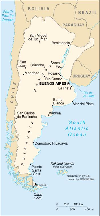
Central and Eastern Argentina Update - November 2001
Climatological Background:
The climate of central and eastern Argentina varies from semi-arid
in the mountainous west to humid subtropical across the vast, flat grasslands
(pampas) of the east. Arid conditions prevail across the southern
part of Argentina where the Patagonian Desert is located. Precipitation
generally occurs throughout the year across central and eastern areas but
displays a marked seasonality, with low rainfall from May to September,
increasing precipitation in October, and a maximum during austral summer.
In the more arid regions of northern Argentina, east of the Andies, the
period May to September is generally dry with the onset of the rainy season
occurring in October.
Flood Risk, Streamflow and ENSO
Given the shallow slope of the terrain across the vast grasslands of
the pampas east of the Andes, runoff is limited and excessive rainfall
often leads to widespread soil saturation and flooding. Several flooding
episodes have occurred over the past 10 years including events in 1998,
1994 and 1993. The floods in 1998 were severe (the city of Parana
observed 1,075 mm of rainfall during May 1998; annual average is 994 mm)
with many areas observing record amounts of rainfall. Flooding and
periods of unusually high streamflow are often associated with El Nino
events, with flooding often occurring towards the end of the rainy season
between March and May. Crop yields in the fertile pampas have also
been linked to the phase of ENSO. Flooding is not always associated
with El Nino with flood events also occurring during both La Nina events
and in non-ENSO years. See figure below.
Nino 3.4 Sea Surface Temperature Index

|
"Pampas" Rainfall Anomaly (34-38S, 58-65W)

|
Recent Rainfall Anomalies:
The average rainfall over the past 12 months has been well above the
long term average across much of central and eastern Argentina including
the pamapas (the ENSO state over this period was that of a fading
La Nina). Heavy rainfall in September 2001 marked an unusually early
onset of the rainy season across sections of the pampas. Precipitation
continued to be well above average in the following month of October with
some areas receiving greater than 300 mm, more than twice the long-term
average for the month. The IRI 3 month WASP (weighted anomaly standardized
precipitation) index is shown below with areas shaded in dark green indicating
extremely wet conditions.
 Map courtesy of the University of Texas Library
|
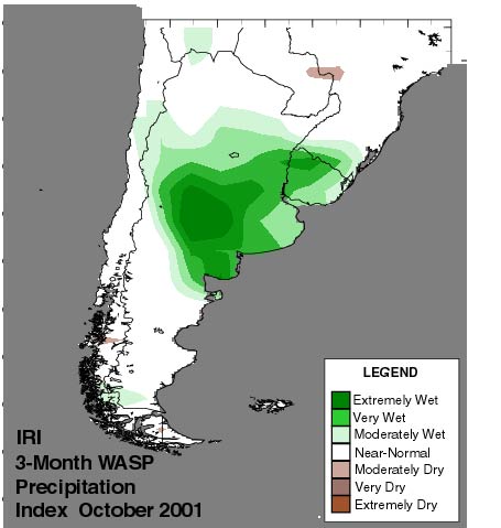
WASP is an acronym for the Weighted Anomaly Standardized
Precipitation index which is based on monthly rainfall departures
from
the long-term (30-year) average.
-------------------------
Standardized Precipitation:
To be able to compare regions with varying amounts of climatological
precipitation, monthly rainfall departures have been divided by their
standard deviation or standardized.
Weighted Anomaly:
To avoid an exaggerated influence of standardized precipitation values
observed during months which are usually dry, they are weighted by
the
fraction of annual rainfall which usually occurs during a given month. |
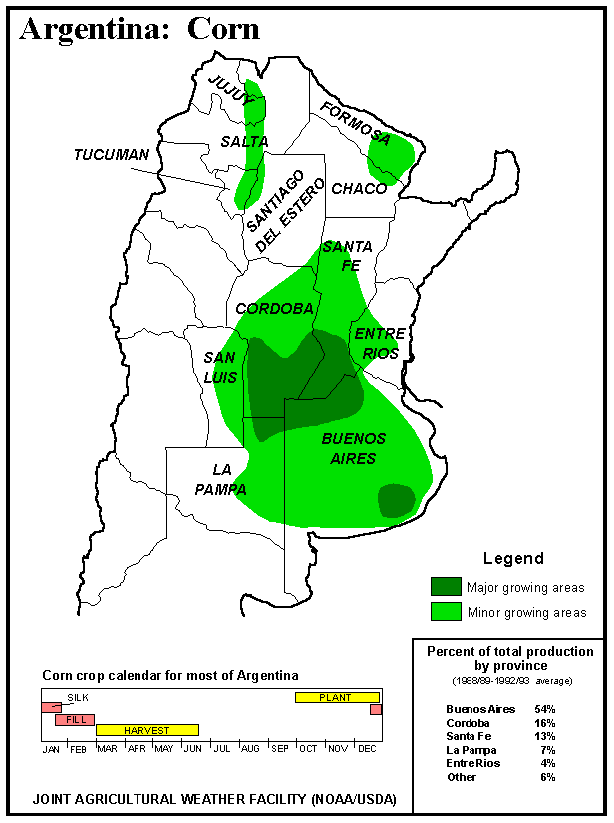
Recent Impacts on Agriculture
The recent heavy rainfall and flooding, though not nearly as severe
as that seen in previous years, has damaged roads and property and impacted
various sectors including agriculture in the Pampas. Immediate
concerns in the agricultural sector include the possible spread of disease
among wheat crops grown in the region due to the unusually wet conditions.
In addition, planting season for corn in the Pampas generally starts in
October (see figure below) and the saturated soils stifle field work and
inhibit proper seed germination. This is situation is especially
acute in important growing areas in Northeast Buenos Aires province as
well as the southern regions of Cordoba and Sante Fe provinces. Overall,
the US Department of Agriculture (USDA) anticipates acreage in corn production
to decline more than 10% (other estimates are as high as 30%) from the
previous year, which itself was below the long term average due to wet
conditions. Given the current situation, many growers are thinking
of shifting some of their corn production to soybeans. In addition
to current market conditions favoring soybean production, soybeans in general
tend to have a higher return per input cost of raising the crop according
to the USDA report*.
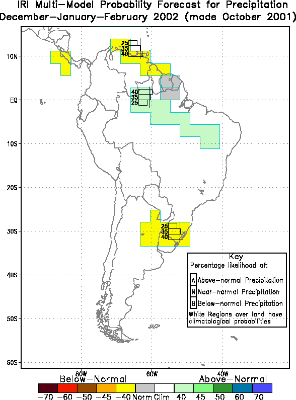
IRI Seasonal Climate Forecast
Oceanic conditions, a crucial factor in producing seasonal climate
forecasts, are currently weak including a near-neutral state of ENSO.
This, combined with uncertainty in the future state of the oceans for the
coming season, is reflected in the precipitation probabilities shown in
the IRI seasonal forecast for South America below. The IRI seasonal
forecasts are given in terms of "terciles", that is, the probability that
rainfall for the season will be above average (top tercile), near-average
(middle tercile) or below-average (bottom tercile). For the period
December 2001 - February 2002, the current forecast indicates a slightly
enhanced probability of below-average precipitation across sections of
northeastern Argentina. These forecasts are produced monthly at the
IRI and are available at: http://iri.columbia.edu/climate/forecast/net_asmt/
*Argentina Grain and Feed Monthly Update for November
Lockup 2001, USDA GAIN Report #AR1071, November 1, 2001.
To Top
Back
to November Impacts
|
