|
IRI Climate Digest
September 2004
August Global Climate Summary
Climatological Background
During August, monsoon systems which bring rains to West Africa, South Asia, and southwestern North America reach their northernmost extent. In the Southern Hemisphere midlatitudes, winter conditions begin to wane by month's end.
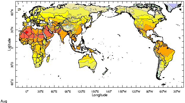
Monthly Mean Temperature (1961-1990), data from the Climate Research
Unit, University of East Anglia

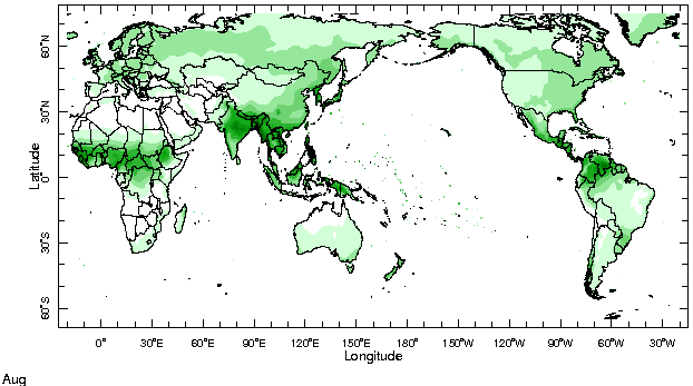
Monthly Mean Precipitation (1961-1990), data from the Climate Research
Unit, University of East Anglia

Temperatures
Highlights
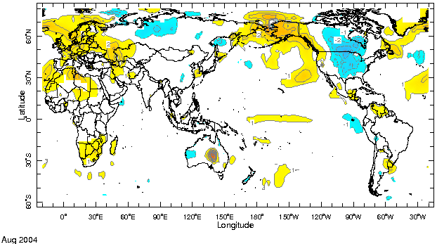
In the mid-latitudes of the northern hemisphere the presence of a trough-ridge pattern in sea level pressure anomalies favored the spreading of relatively warm air from the adjacent oceans into the western tiers of North America (especially Alaska) and Europe. Farther east, across the central and eastern tiers of North America and Eurasia, cooler-than-average conditions prevailed. Above-average temperatures persisted across much of South America (the exception being tropical latitudes along the west coast and the central Andes), western and southern Africa and south-east Asia.
Temperature Difference from the 1961-1990 mean, with data
from NCEP Climate Prediction Center, CAMS.

Precipitation
Highlights
The most notable positive precipitation anomalies were centered over the western tropical Pacific Ocean, east-northeast of the Philippines. Positive rainfall anomalies were recorded in parts of South Asia, most notably Gujarat in western India, and the northwestern Bay of Bengal. Much of peninsular India recorded below-average rainfall, as did Sri Lanka and Indonesia. Rainfall was close to average across the African Sahel and below average along the Atlantic Intertropical Convergence Zone, from West Africa across the Atlantic and into northern South America, Central America and the Caribbean. The region of the South Atlantic Convergence Zone, extending southeastward into the ocean from southern Brazil, Uruguay and Paraguay, was also drier than average.
Precipitation Difference from 1979-1995 mean, with data
from NCEP Climate Prediction Center, CAMS-OPI.


Oceanic Conditions
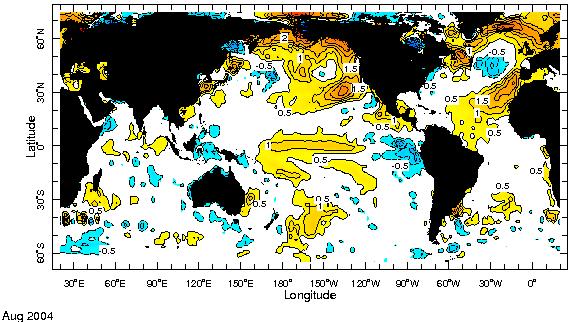
Temperature anomalies greater than 1°C were observed in the central equatorial Pacific during August. See the latest IRI ENSO Update for a detailed summary and outlook for the tropical Pacific. Apart from the these anomalies, the most notable feature in the sea surface temperatures was the persistence in the warming of the eastern boundaries of the mid-latitude gyres (i.e., large-scale mid-ocean circulations) of the North Pacific and North Atlantic. The warming extended southwestward into sub-tropical latitudes, and was counterbalanced by cooling in the centers of the gyres. Weak warming tendencies were noted in the equatorial Indian Ocean, centered around 75E, and in the South Atlantic, around 30S and 20W.
Monthly Sea Surface Temperature Difference from the 1971-2000 mean,
with data from the Environmental Modeling Center, NCEP/NOAA.

Contents |
Special |
Impacts |
Climate |
Forecast
|
