|
IRI Climate Digest
November 2002
October Global Climate Summary
Climatological Background
During October, the Northern Hemisphere mid-latitude storm tracks increase in strength, while monsoon systems in West Africa, South Asia, and southwestern North America continue their retreat southward following the maximum solar heating. Late season tropical storm activity continues in the North Atlantic, the North Pacific and northern Indian Oceans. Spring is underway in the Southern Hemisphere, with mid-latitude storm tracks losing strength.
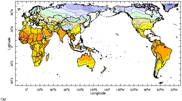
Monthly Mean Temperature (1961-1990), data from the Climate Research
Unit, University of East Anglia

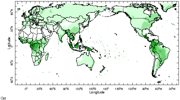
Monthly Mean Precipitation (1961-1990), data from the Climate Research
Unit, University of East Anglia

Temperatures
Highlights
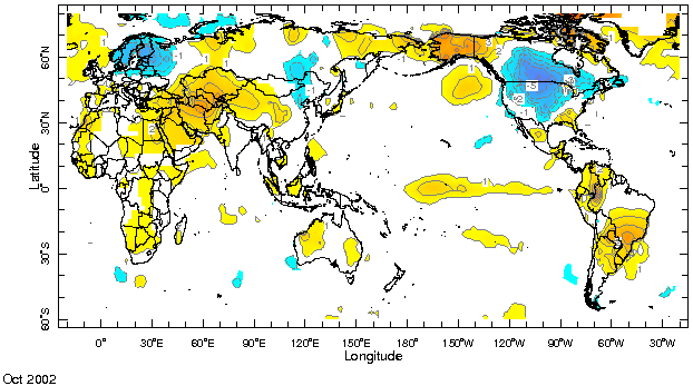
Temperatures turned markedly below average in Central North America and northern Europe while unusually warm conditions continued in Southwest Asia, Southeastern South America and Alaska.
Temperature Difference from the 1961-1990 mean, with data
from NCEP Climate Prediction Center, CAMS.

Precipitation
Highlights
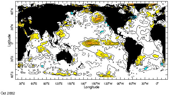
Rainfall anomaly patterns often associated with El Nińo have been developing in a number of regions. For example, the excess rainfall near the dateline in the equatorial Pacific Ocean is associated with the warmer than average oceanic temperatures there and signal the rising branch of the equatorial Walker circulation. The drier than normal regions of Indonesia and the Maritime continent and eastern Australia in the western Pacific and the Amazon region east of the Andes, are associated with the sinking branches of the Walker circulation. The wetter than average short rains are common in East Africa and Dry conditions have been developing over much of southern Africa and Madagascar. In mid-latitudes, the wetter than average conditions in southeastern South America and the relative dryness seen in the Northwest U.S. are typical during El Nińo during northern hemisphere fall and winter.
Precipitation Difference from 1961-1990 mean, with data
from NCEP Climate Prediction Center, CAMS-OPI.


Oceanic Conditions
Tropical Pacific: The current El Nińo continued to mature during October, but is not expected to exceed moderate strength. Its broad region of anomalously warm water extended its reach into the eastern Pacific, while sea surface temperatures (SSTs) in the central Pacific are now as high as 2.5°C above normal. See the latest IRI ENSO Update for a detailed summary and outlook.
Tropical Atlantic: Near normal conditions continue to prevail over most of the tropical Atlantic basin.
Indian Ocean: Warmer than average surface temperatures continued to develop as the strongest anomalies became more dominant in the western and central regions of the ocean.
Mid latitudes: The cold anomalies in southeastern Pacific and north central Pacific continued, as did the warm anomalies in the Gulf of Alaska. Warm anomalies also developed off the southeastern coast of South America.
Monthly Sea Surface Temperature Difference from the 1950-1979 mean,
with data from the Environmental Modeling Center, NCEP/NOAA.

Contents |
Special |
Impacts |
Climate |
Forecast
| 