|
IRI Climate Digest
May 2006
Climate Impacts - April
Contributions to this page were made by IRI researchers
M. Bell,
Dr. A. Giannini,
E. Grover-Kopec,
Dr. B. Lyon,
C. Ropelewski
Hazards/Threats
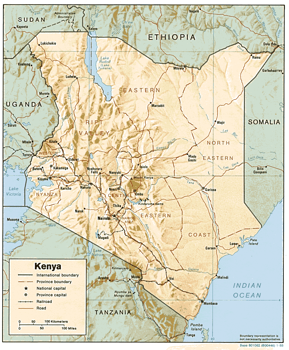
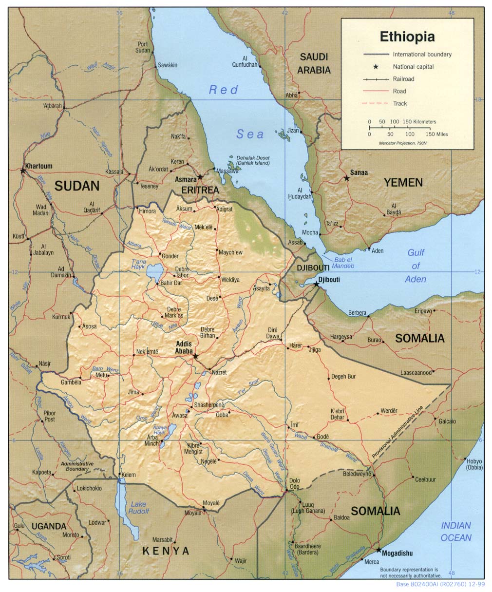
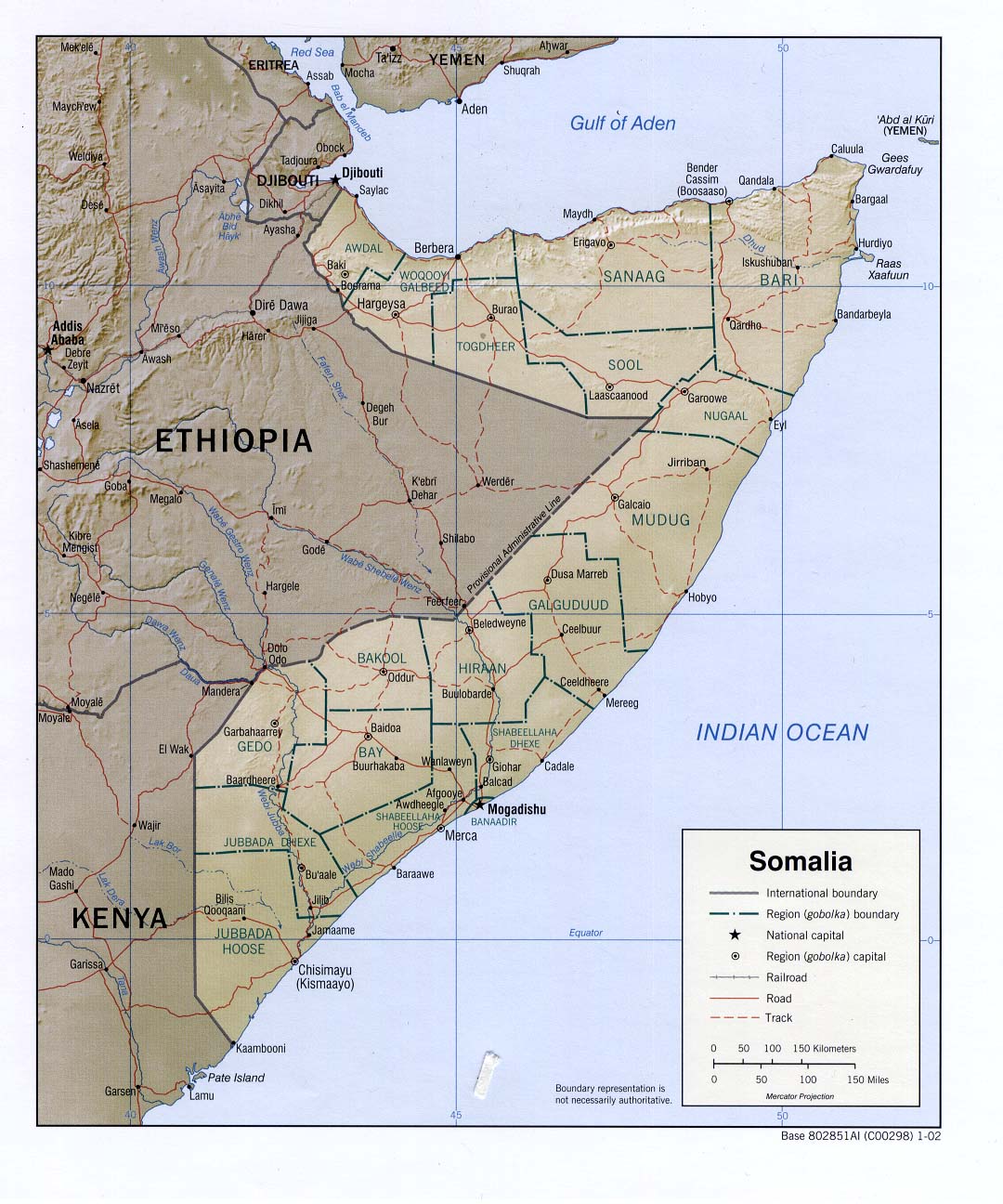
Africa - Africa: Greater Horn
Although much of the area in the Greater Horn of Africa (Reference Map) most affected by several consecutive seasons of precipitation deficits, including Ethiopia, southern Somalia, and northern Kenya, started receiving plentiful rainfall around the beginning of April (April 2006 Precipitation Percentile Map), the heavy rains caused hazardous flooding, particularly in parts of Kenya. Flooding along the Uaso Nyiro River in the Isiolo district of central Kenya displaced about 3000 people (IRIN, IFRC). In southeastern Kenya, as many as 10,000 people were displaced and more than 100 homes were destroyed when the Sabaki River flooded after heavy rains (AP, IRIN, DFO Map).
The Awash River in eastern Ethiopia flooded in mid-April, displacing 10,000 people and causing the destruction of approximately 200 homes. About 400 sheep and goats were lost as well (IRIN). Floods in late April killed five people, submerged several villages, and killed hundreds of livestock in the Hiraan region of south-central Somalia (IRIN).
Despite the above-normal rainfall in these areas, full recovery will require several seasons of good rainfall, and the current food security crisis continues (FEWS Net, Apr 2006 CID). According to FEWSNet, even if the above-normal rainfall in April in the pastoral areas continues long enough to replenish pastures and water supplies, it will take a long time for pastoralists in the region to recover from the drought and extreme livestock losses (FEWS Net, FEWS Net).
The latest IRI seasonal precipitation forecast for June-August 2006 indicates a slightly enhanced probability of below-normal precipitation in a small area of southern Somalia and a slightly enhanced probability of above-normal precipitation over Djibouti and surrounding areas in eastern Eritrea, northern Somalia, and northern Ethiopia.
Asia - Afghanistan
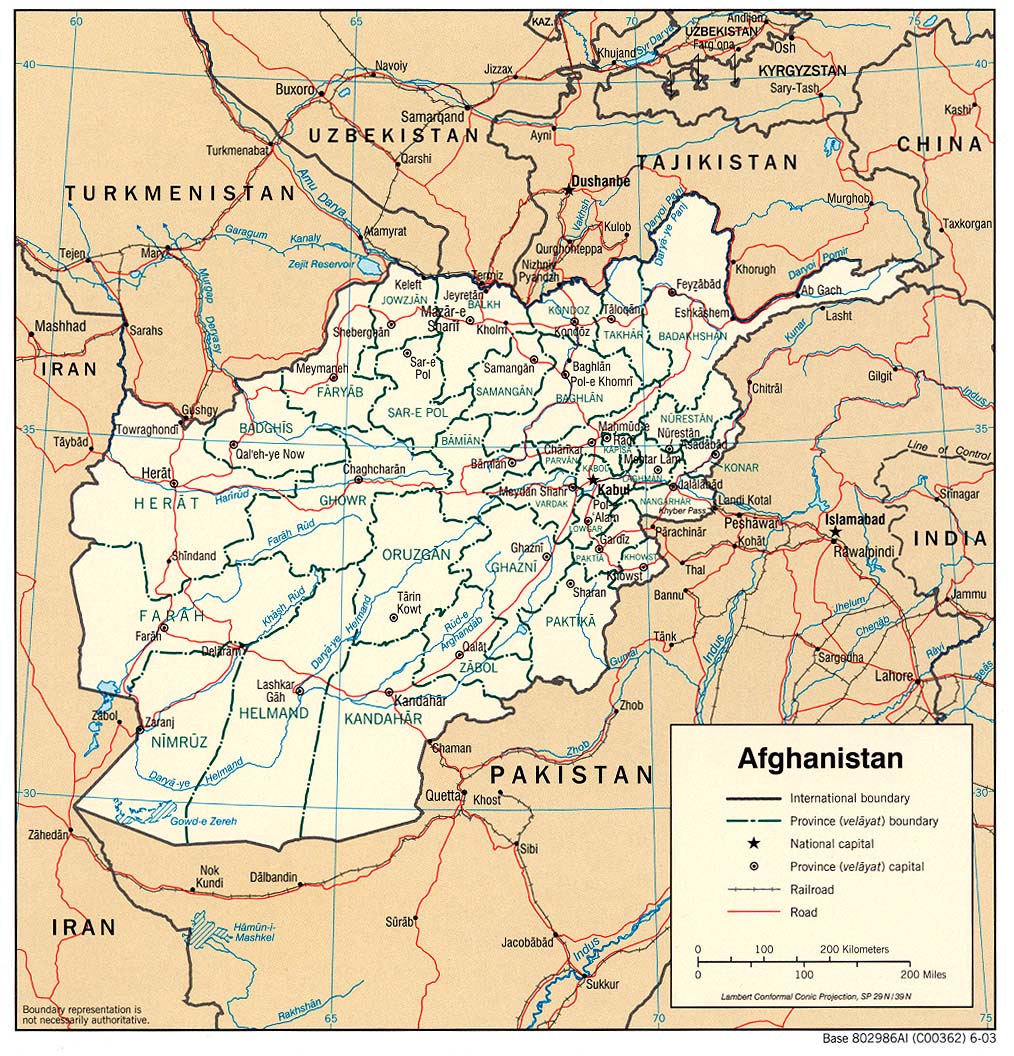
Spring flooding, caused by snowmelt and seasonal rainfall, affected numerous provinces in northern Afghanistan during April. At least 16 people were killed in the provinces of Faryab and Baghlan, which were among those hardest hit. Approximately 200 families were affected in Faryab province where at least 215 homes, 39 mills and 71 water dams were completely destroyed. At least 3000 livestock were also lost in the flooding. (IFRC, IRIN) Flooding also affected the provinces of Samangan, Sar-e-Pol and Herat during April. According to the Ministry of Rural Rehabilitation and Development, 30 homes and 750 hectares of farmland were destroyed in Samangan after heavy rains fell in the area. (IRIN) The Afghan government, World Food Program (WFP) and Afghan Red Crescent Society have been providing aid to those affected by the flooding, although WFP has warned that it is facing a severe funding crisis for its operations in the region.
In January, which is the mid-point of the climatological wet season for much of Afghanistan (November-April), flooding and storms were blamed for the deaths of 48 people in 13 provinces (January 1-Month WASP Index Map). Badakhstan was among those worst hit when heavy snowstorms moved through the region. At least 42 people were killed and 1000 homes were destroyed in the northeastern province. (IRIN, WFP, Feb 2006 CID)
Europe - Europe: Central,Europe: East
Flooding that began in March in Eastern Europe as a result of heavy rainfall and snowmelt continued through April and into early May (April 2006 CID). Flooding along the Danube River and its tributaries has caused the greatest damage in Romania, Serbia, and Hungary, but parts of Bulgaria, Ukraine, Slovakia, and Croatia have been affected as well (BBC Map). Persistent heavy rains (April 2006 Precipitation Anomaly Persistence Map) and high temperatures (April 2006 Temperature Percentile Map), which have contributed to rapid snowmelt, raised the Danube River to its highest level in decades, or even in more than a century, in some locations along its course. As of late April, according to the Romanian government, as many as 16,000 people had been evacuated from their homes to escape the floods (BBC, AP). About 1,500 homes in Romania have been flooded, and 440 have been destroyed. Approximately 130,000 hectares of land were under water, about 70,000 hectares of which were flooded deliberately in order to prevent damage in nearby towns. An early estimate puts losses in Romania at about USD 8.6 million (Reuters). In Serbia, approximately 3,000 homes were flooded and 225,000 hectares of land were flooded or threatened by flooding. The Serbian Finance Ministry has announced that EUR 20 million will be allocated to repair damage. In Hungary, as much as 138,000 hectares of fields were under water and according to the state news agency, insurance claims may reach as high as USD 4.72 million. (DFO Map, DFO Map, DFO Map, DFO)
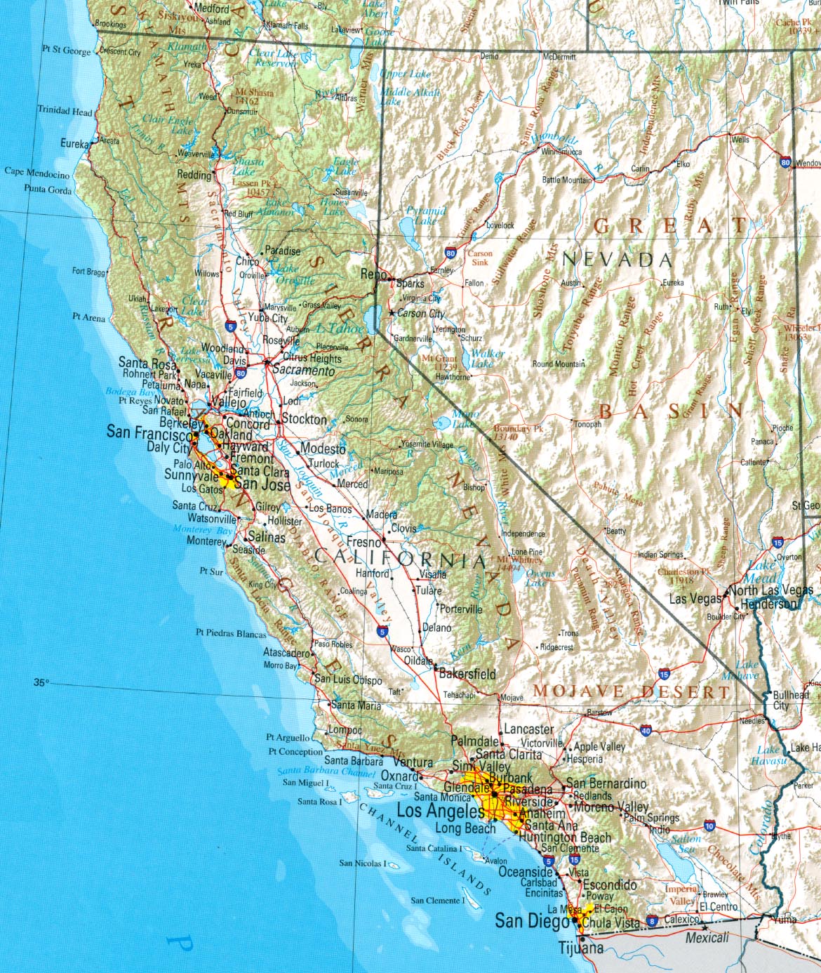
North America - United States: West
Heavy rainfall that persisted for about two weeks in April (April 2006 Precipitation Percentile Map) caused flooding along the Merced, Consumes, San Joaquin, Sacramento, and Navarro Rivers (NASA, DFO Map) in the central section of the U.S. state of California. High water levels broke through levees along the Merced River, flooding a trailer park and prompting the evacuation of 200 people. One person was killed in a mudslide (AP). California's governor declared a state of emergency in sixteen counties and has reportedly asked for USD 6 billion to repair the state's system of levees.
North America - Canada,United States: Great Plains
Above-normal rainfall in March, and melting snow caused unusually heavy seasonal flooding in April in the Red River basin located in southern Manitoba, Canada, and the U.S. states of North Dakota and Minnesota. Water levels in the city of Winnipeg reached their highest stage since the record floods of 1997 (CTV). In Fargo, North Dakota, students were reportedly released from classes to help with sandbagging efforts (CTV). As of mid-April, flood-related costs and damage had risen above USD 1 million for Cass County and the city of Fargo, North Dakota (AP). A report from the Dartmouth Flood Observatory indicated that approximately 100,000 acres of farmland had been flooded, and damage from the flooding in Canada was estimated at USD 12 million (DFO). (DFO Map, CBC)
South America - Brazil
Abnormally heavy rainfall in the Brazilian state of Para caused flooding along the Tocantins, Xingu and Tapajos Rivers, all of which are Amazon tributaries. The flooding, which occurred during late-March to late-April, was blamed for the deaths of 8 people and affected another 116,000. The climatological rainy season in that region occurs during January-May. (AFP, March-April Precipitation Percentile Map)
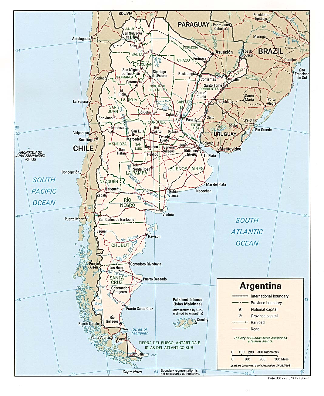
South America - Argentina
Portions of northern Argentina experienced significant flooding and landslides during April due to relatively heavy rainfall during March, which is typically near the end of the rainy season (Climatological Precipitation Animation). Northern Salta, eastern Jujay and western Formosa felt impacts of the flooding that affected approximately 250,000 km� along the Bermejo, Pilcomayo, Seco, and Tartagal Rivers. Estimates indicated that more than 1000 families were affected and 1500 people were evacuated, although more specific numbers are unavailable due to lack of access to the flooded areas. Reports also indicate that 150 homes and several bridges were destroyed. Most of the affected population live in aboriginal Guaran�es, Wichis and Matacos communities that, due to long-term socio-economic problems, are vulnerable to such disasters. National- and provincial-level authorities, as well as the Argentine Red Cross, are providing relief aid to these communities. (IFRC, IFRC Map)
Health
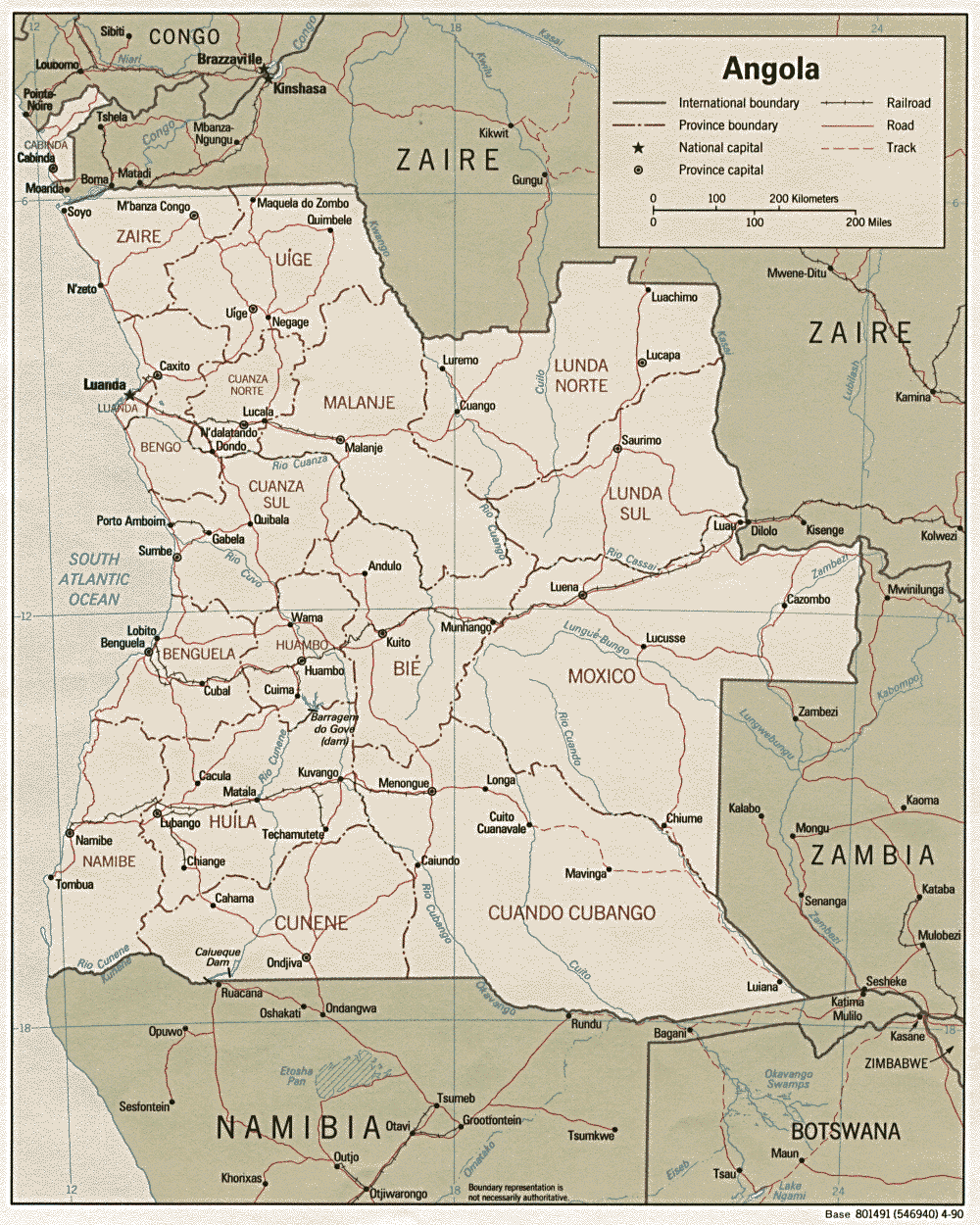
Africa - Angola
A cholera epidemic in Angola, said to be the war-torn country's worst ever, has continued to spread and increase in severity. While overcrowding and poor sanitation conditions in the least developed suburbs of Luanda sparked the outbreak in mid-February, heavy rainfall during April exacerbated the situation (April Precipitation Percentiles Map). According to the World Health Organization, 1300 deaths and 35,000 cases had been reported as of 18 May and as many as 500 new cases are being reported each day. Those displaced to slums by the civil war, which ended in 2002, have been most affected by the epidemic. The 27-year war, however, restricted travel within Angola and kept these types of water-borne diseases from spreading quickly. Consequently, this is the first outbreak in Luanda in more than 10 years. Post-war development is reportedly now aiding the spread of the disease as it moves with people traveling along the country's improved road system. The Angolan government has earmarked USD 5 million to respond to the epidemic. UN agencies, such as WHO and UNICEF, and NGOs, particularly MSF, are also actively engaged in controlling the situation and caring for the ill. (IRIN, IRIN, AFP, Xinhua, Reuters, AFP)
Water Resources
No reported impacts this month associated primarly with water resources
Agriculture
No reported impacts this month associated primarly with agriculture
Contents |
Special |
Impacts |
Climate |
Forecast
|
