|
IRI Climate Digest
May 2004
Climate Impacts - April
Contributions to this page were made by IRI researchers
M. Bell,
Dr. A. Giannini,
E. Grover,
Dr. B. Lyon,
C. Ropelewski,
Dr. A. Seth
Hazards/Threats
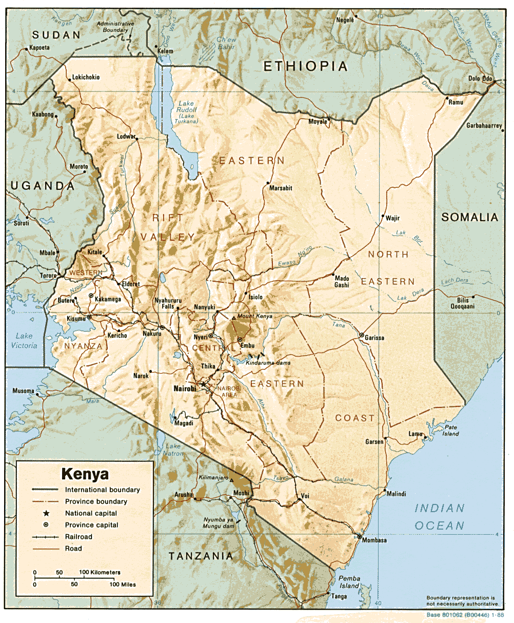
Africa - Djibouti,Kenya
In Kenya, heavy rainfall and flooding which began in early April continued into early May and resulted in the deaths of at least 50 people. At
least 10,000 people were displaced from their homes and an additional 15,000 were affected. Locations around Lake Victoria and
along rivers in western Kenya, including the Nyando, Ombeyi, and Miriu were affected the most. Schools, homes, livestock and
other property were damaged. Flooding in the Tana River basin in eastern Kenya was reported as well (IRIN, IRIN, IFRC)
Elsewhere in the region, areas of Ethiopia, southern Sudan, Uganda, and Djibouti received above-normal rainfall in April. About three days of
heavy rainfall in mid-April caused flash flooding in Djibouti, including the city of Djibouti, killing at least 53 people and displacing at
least 1500 (IRIN, IFRC, IFRC).
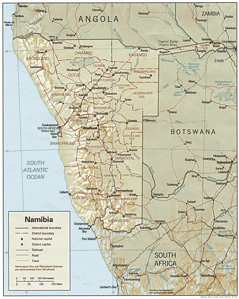
Africa - Namibia,Zambia
Persistent rainfall (Jan-Mar 2004, Feb-Apr 2004 precipitation persistence maps) in the Zambezi River basin since at least
December 2003 has led to prolonged flooding along the river. It continued to rise into mid-April and flood surrounding territory in
western Zambia and the Caprivi strip of Namibia. In recent weeks, about 2,500 to 3,000 people living along the river in the Caprivi
strip were evacuated to camps on higher ground. Two flooding-related deaths in Namibia were reported, large portions of the
maize crop have been destroyed, and as many as 15,000 cattle were in danger of being stranded by the floodwaters. The floods
have been characterized as the worst in the Caprivi strip since 1958 (IRIN, IRIN, IRIN).
In western Zambia, at least 21,200
people have been affected by the flooding. According to an official with the office of the UN Resident Coordinator in Zambia, the
earlier-than-normal start of the flooding prevented many families from escaping the rising waters as they normally would in a more
typical year (IRIN). The most affected areas in the Western and North Western Provinces of Zambia are on the west side of
the river (ReliefWeb map). Water and sanitation facilities have been seriously damaged and there have been some reports of outbreaks of
water-borne diseases. Rice and maize crops in the districts of Kalabo, Mongu, and Lukulu of Western Province have been heavily
damaged, and there is some concern that food security could be affected in coming months (OCHA, DFO).
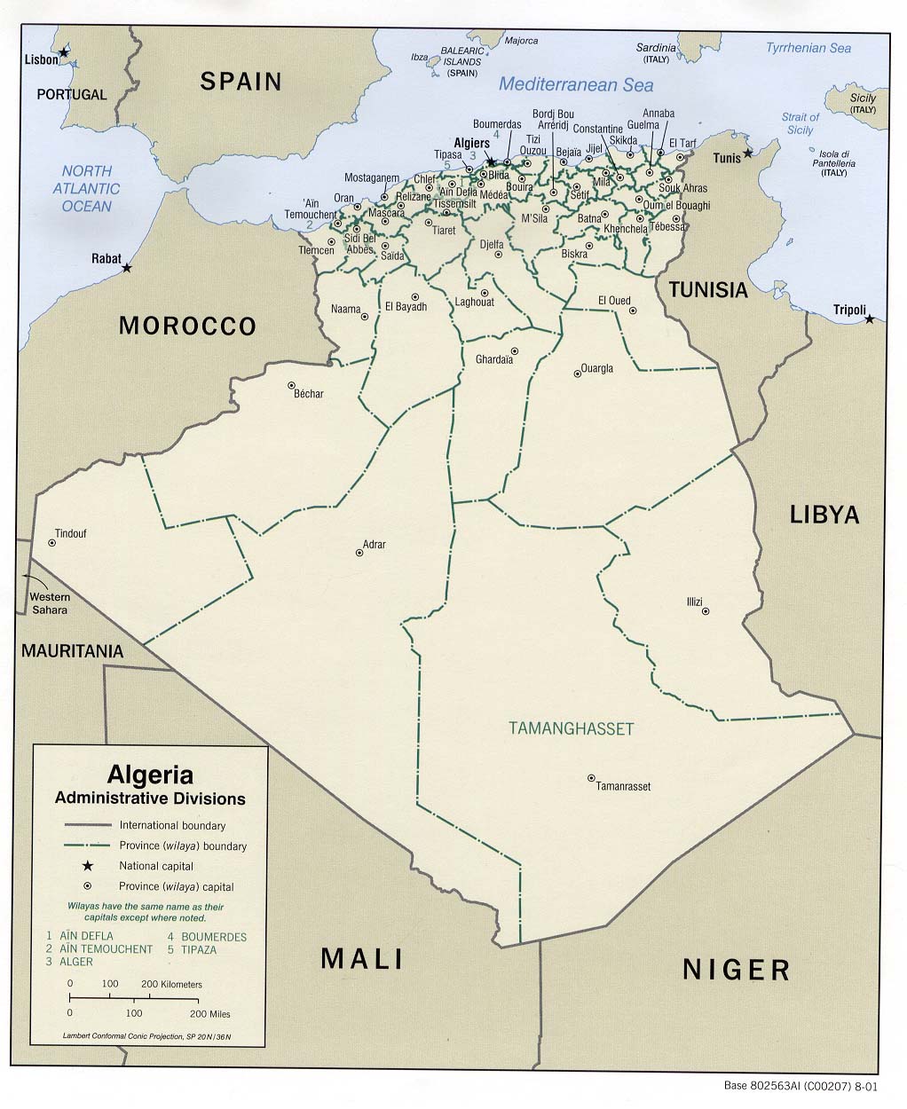
Africa - Algeria
Torrential rains fell in mid-April in the typically arid region of central
Algeria (ReliefWeb Map). Over 40 mm (1.5 in)
of rain fell in three days in areas that rarely receive more than a few
millimeters of precipitation at a time and no more than 10-20 mm of precipitation
during the entire year. Many dwellings
in this area are made of natural materials that are not meant to withstand
this type of heavy precipitation, leading to large amounts of damage to
infrastructure.
Tentative estimates by the Directorate-General of Civil Protection indicate
that the rains caused 3 deaths and affected 1400 homes and 5500 people
in the area of Timimoun, where the greatest amount of infrastructure
damage was seen. Over 2400 people were evacuated from their homes as 680
dwellings were declared uninhabitable. The areas of Gourara, Tinerkouk,
Charouine, Ouled Sa�d, Tsabit, and Sba� also felt the impact of
the heavy rains as over 1000 families suffered damage to their homes.
Additional reports of impacts from these rains are expected as houses
break down due to weakened walls and as word travels from less
inhabited regions. The Algerian government set up a national crisis group
within the Ministry of the Interior to help address the impacts of the rains.
The Algerian Red Crescent also mobilized volunteers and aid to meet
the needs of the affected population. (IFRC, http://www.lematin-dz.net/)
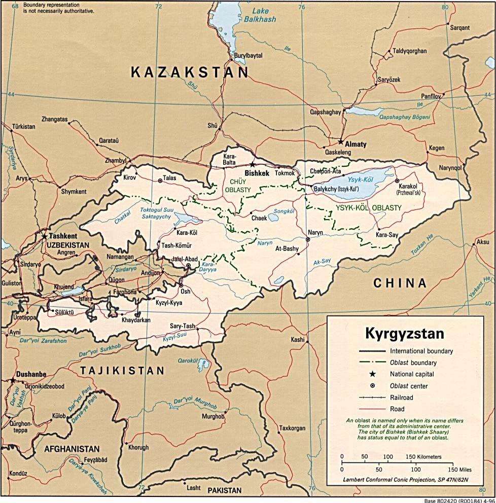
Asia - Kyrgyzstan
Heavy rainfall during April played an important role in triggering over 20
landslides in southern Kyrgyzstan. According to the Kyrgyz meteorological
service, some areas have received three times their normal amount of
precipitation this spring. (IRIN) Forty people have been killed in landslides since the beginning of 2004. This
four-month total has already surpassed the annual total from 2003 (i.e., 39
deaths), which, in turn, had 8 times as many landslides as in 2002. Most of
the deaths this year occurred as the result of a series of rain-triggered slides
in late-April in the Alay district in Osh Province. (ReliefWeb Map) Fifty head of livestock were also lost
in those landslides, one of which was estimated to be 3 million cubic meters in
volume. (OCHA, IRIN, OCHA, IRIN, IRIN)
There are over 4000 landslide-prone areas in southern Kyrgyzstan,
most of which lie in the Ferghana Valley area. The nature of the soil (i.e.,
large amounts of clay and lime) and the normal occurence of seismic tremors,
along with climatic factors such as April's heavy rainfall, combine to
make this region particularly susceptible to landslides. (IRIN)
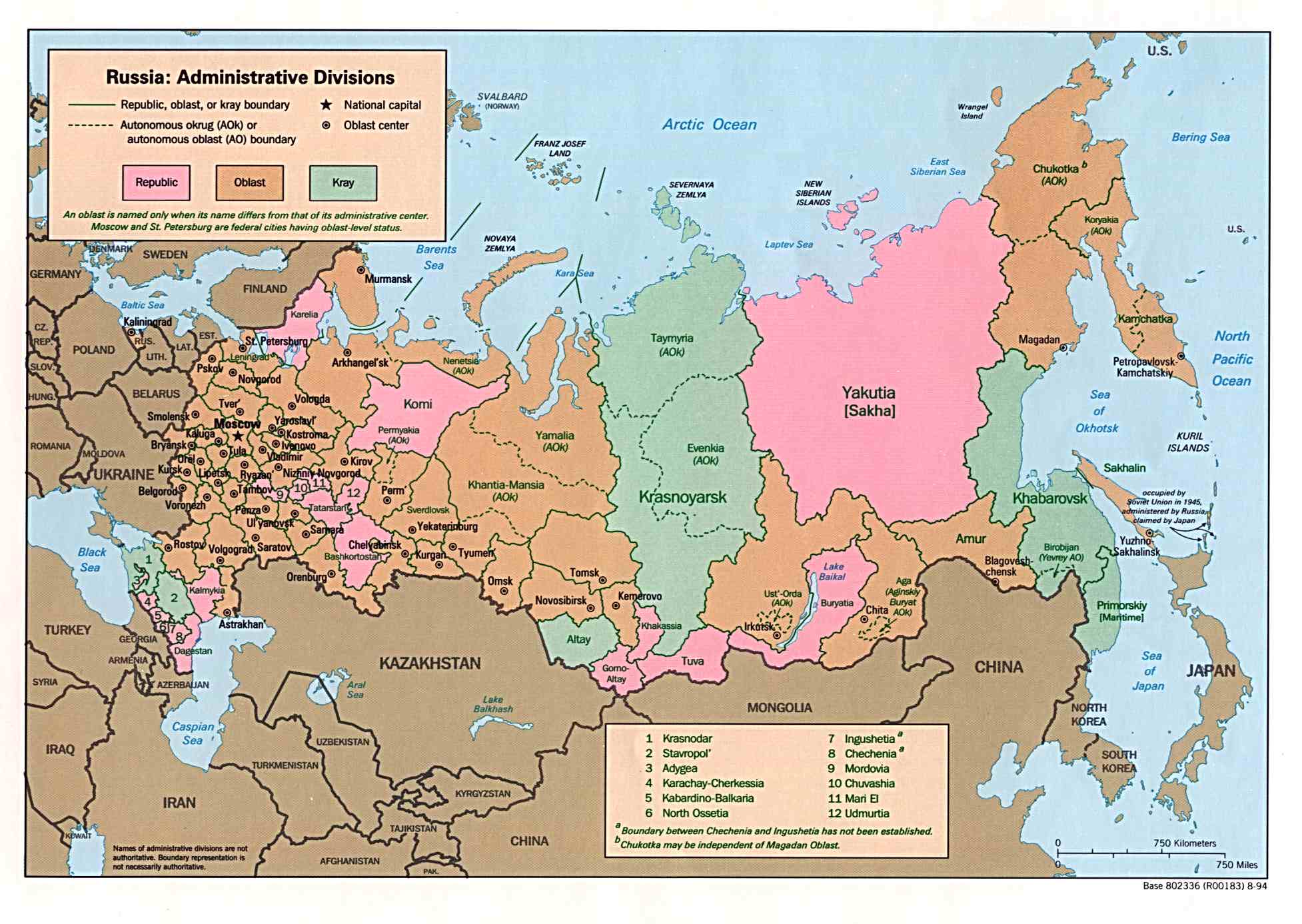
Asia - Russia
Above-normal rainfall (April WASP Index), snow melt and ice jams caused flooding in
Kemerovo, Altay, and Tomsk oblasts in southern Siberia and Kourgan oblast
in the South-Ural region of Russia. (ReliefWeb Map) Much of the flooding was along the Abakan, Ob, Knodoma,
and Tom Rivers. The governor of the Kemerovo region estimated losses due to the
flooding to be about USD25 million. Approximately 5000 homes housing 23,500 people were
inundated in 22 towns and villages. Reports have indicated that as many as
18 people died as result of the floods. Russia's EMERCOM reported that, as of
April it
had enough resources to deal with the impacts of the flooding, and the situation
in southern Siberia was stabilizing. (OCHA, DFO)
Europe - Bosnia and Herzegovina
Heavy rains during April (April WASP Index) caused flooding along the Danube tributaries in northwestern, central, and northeastern parts of Bosnia and Herzegovina (ReliefWeb Map). The Pliva, Vrbas, Bosna, Sana, Vrbanja, Josavka, Una, Lasva, Zdena, Drina and Sava Rivers were among those affected. Water levels along the river Sana reached 425 cm, the highest in the last fifteen years. The most affected areas in the 48 municipalities that were flooded declared states of emergency when the floods were at their highest point. Approximately 300,000 people were affected when 5000 homes were flooded and 20,000 hectares of crop land were damaged. Eighty percent of the population in the affected areas are dependent on agricultural proceeds for their livelihood. This dependence on agriculture is an important factor in the expectation that the crop losses will impact food security in the medium- to long-term. Access to many of the affected areas has been difficult due to damage to roads and other basic infrastructure. Water sanitation is also of concern due to water wells being contaminated by sewage overflows. (IFRC, OCHA, World Vision)
Health
Asia - Indonesia
From 1 January to 30 April 2004, over 58,300 cases of dengue and dengue hemorrhagic fever and 658 deaths were reported
throughout 30 provinces of Indonesia. DPA has reported that for the 2003/2004 rainy season as a whole, over
1000 dengue deaths have been reported. The magnitude of the current dengue outbreak is being compared to the pandemic of 1998 in which
Indonesia reported 72,133 cases and 1414 deaths (WHO). With the approach of the end of the normal rainy season, the number of dengue cases in
Indonesia returned to near-normal levels in April. Although dengue occurs every year during the rainy season in Indonesia, large outbreaks tend to recur about every five years, primarily among
non-immune children born after the previous epidemic (BBC). Precipitation during the 2003/2004 rainy season appears to have been generally near normal. (AFP, WHO)
According to the latest IRI seasonal precipitation forecast for June-August 2004, slightly enhanced probabilities of below-normal precipitation are indicated for most of Indonesia, with the exception of southern Sumatra, where slightly enhanced probabilities of above-normal precipitation are forecast.
Water Resources
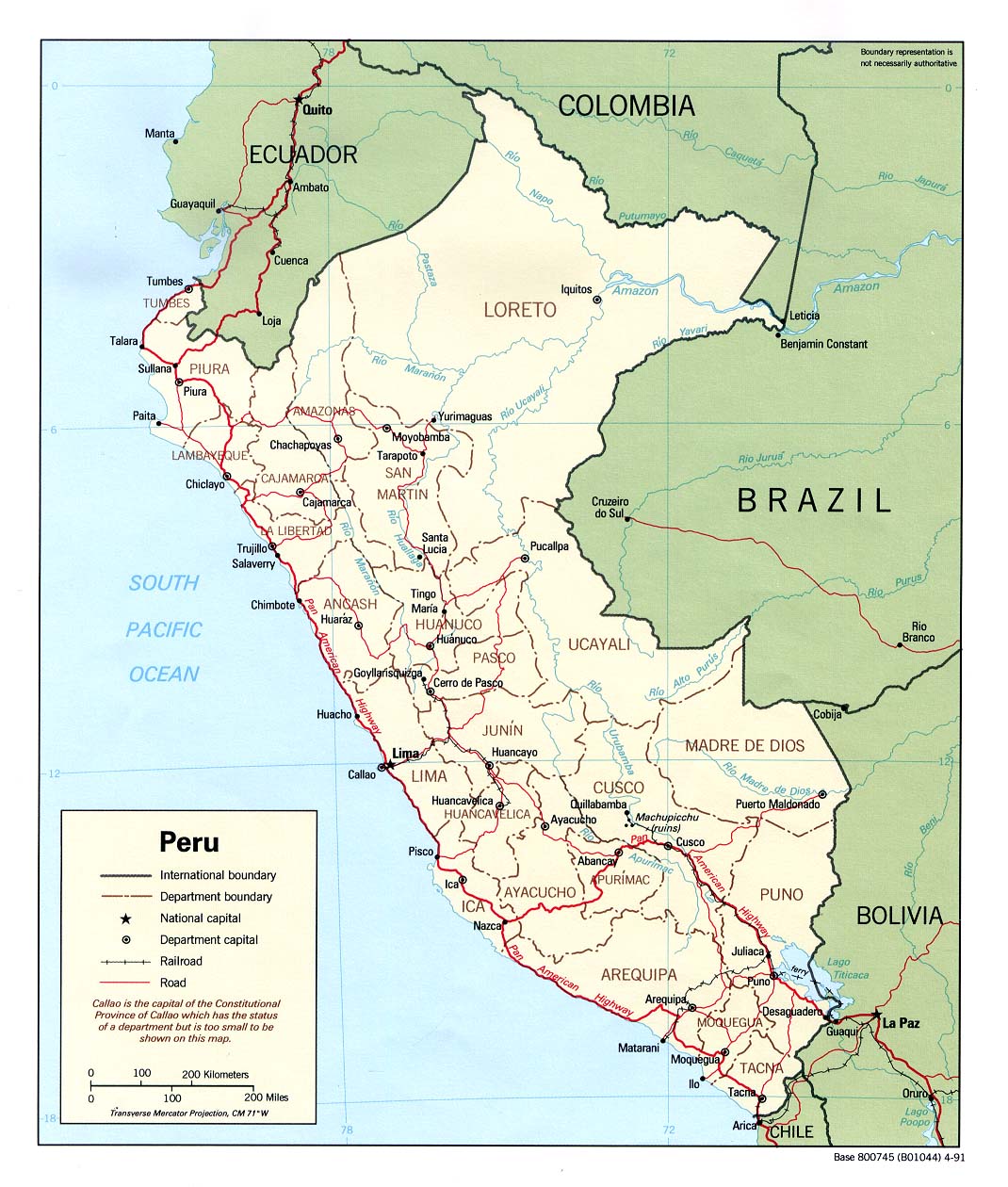
South America - Peru
Below-normal rainfall in the Andes is affecting water resources and agriculture
in Peru. (ReliefWeb Map) The state-run water company, Sedapal, has been forced to
apply the worst water restrictions in the capital city of Lima in 10 years.
In January and February, water was only
available to 90% of the city's 8 million residents from 5:00 AM to
5:00 PM. Good rainfall in March contributed to the suspension of
these restictions, but they resumed in early May. Recovery from the recent
precipitation deficits is not expected for some time as April marked the end
of the climatological rainy season in most of the affected areas. The
water restrictions are therefore expected to be in effect for the remainder of the year. (Reuters, BBC)
The President of Peru declared a state of emergency for the departments of
Puno in southeastern Peru and Cajamarca in northwestern Peru. Agricultural interests in the department of Cajamarca
have been hit particularly hard by the drought as 16,000 ha of crops have been lost and 18,000 ha
of crop land and pasture have been severely affected. The WFP has reported agricultural drought damage in the neighboring departments of Piura and Lambayeque as well. (OCHA)
Agriculture
Africa - Africa,Africa: North,Africa: West
After good rains in March, additional rainfall in locust breeding areas in northwestern Africa (reference map) in April contributed to favorable conditions
for the continued growth of desert locust populations. According to the FAO, as of the end of April, hatching and the
formation of hopper bands continued in Morocco and Algeria south of the Atlas Mountains. New swarms were forming in Western
Sahara and northern Mauritania and were damaging oases, pastures, and crops. Small bands of hoppers and immature adults were
reported in Niger as well (FAO map, April 2004). Precipitation estimates indicated that most areas of northwestern Africa, including breeding
areas south of the Atlas Mountains in Morocco, Algeria, Tunisia, western Libya, and in Western Sahara received rainfall beneficial to locusts during
April. Control operations (primarily insecticide application) have been hampered in Mauritania and Niger by a lack of money and resources
and the often remote locations of locust populations (IRIN). Nations in northwest Africa have spent about US$17 million on
control efforts since October 2003, but the FAO estimates that an additional US$17 million is needed for successful control efforts
through the summer season. FAO has characterized the locust situation as the worst in ten years. The greatest concern is that
large numbers of locusts may move southward into the Sahelian region in West Africa as early as the end of May and cause
extensive crop damage during the summer growing season (FAO). Citrus crops in Morocco may be at risk as well (AFP).
The latest IRI seasonal precipitation forecast for June-August 2004 indicates a slightly enhanced probability of above-normal precipitation for Senegal, Guinea-Bissau, western Guinea-Conakry, southern Mauritania, and areas of western Mali, and below-normal precipitation along the Guinea Coast and northeastward into the Sudan.
Contents |
Special |
Impacts |
Climate |
Forecast
|
