The seasonal cycle over the tropical Pacific in general circulation models
Abstract
The seasonal cycle over the tropical Pacific simulated by eleven coupled ocean-atmosphere general circulation models (GCMs) is examined. Each model consists of a high resolution ocean GCM of the tropical Pacific or near-global oceans, coupled to a moderate or high resolution atmospheric GCM, without the use of flux correction. The seasonal behavior of sea surface temperature (SST) and eastern Pacific rainfall is presented for each model.
The results show that current state-of-art coupled GCMs share important successes and troublesome systematic errors. All eleven models are able to simulate the mean zonal gradient in SST at the equator over the central Pacific. The simulated equatorial cold tongue generally tends to be too strong, too narrow, and extend too far west. SSTs are generally too warm in a broad region west of Peru, and in a band near 10oS. This is accompanied in some models by a double inter-tropical convergence zone (ITCZ) straddling the equator over the eastern Pacific, and in others by an ITCZ that migrates across the equator with the seasons; neither behavior is realistic. There is considerable spread in the simulated seasonal cycles of equatorial SST in the eastern Pacific. Some simulations do capture the annual harmonic quite realistically, although the seasonal cold tongue tends to appear prematurely. Others overestimate the amplitude of the semi-annual harmonic. Nonetheless, the results constitute a marked improvement over the simulations of only a few years ago, when serious climate drift was still widespread, and simulated zonal gradients of SST along the equator were generally poor.
Figure 1: Annual mean SST along the equator, averaged between 2oS and 2oN
Figure 2: The seasonal cycle in equatorial SST (2oS-2oN), in terms of deviations from the respective annual mean given in Fig. 1. Contour interval is 0.5oC, and negative anomalies are stippled.
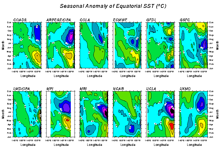
Figure 3: Maps of mean SST for April. Contours are every 1oC.
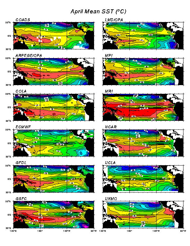
Figure 4: Maps of mean SST for October. Contours are every 1oC.
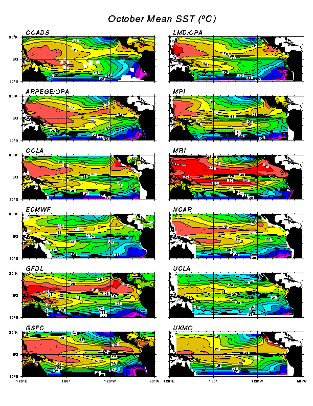
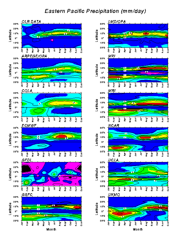
Figure 5: The seasonal cycle in precipitation over the eastern Pacific (averaged between 150oW and 100oW), plotted against latitude. For the GFDL model, precipitation minus evaporation is plotted. The observed estimate is derived from cloud-top temperatures for 1986-89 (Janowiak and Arkin 1991). Contour interval is 2 mm/day, with values greater than 6 mm/day stippled.