Seeing More with Satellites: Improving Insurance for African Farmers
By Bristol Mann and Radost Stanimirova
A group of climate scientists, economists and remote sensing experts from the International Research Institute for Climate and Society and NASA’s Goddard Space Flight Center are collaborating to help solve a longstanding issue in the development of agriculture insurance programs in Africa: how to generate enough quality environmental data so that these programs can scale up to cover more farmers. Our project will test to see if Earth-observing satellites can provide an accurate historical environmental data record and capture ground conditions in real time. The potential of satellite imagery in applications such as crop insurance is vastly exciting; however there are significant implications for misinterpretation of satellite data that must be accounted for. This project is designed to take advantage of partnerships with remote sensing scientists to ensure that the most appropriate products are being reliably interpreted in local and continent-wide scales. Ultimately, the research outcomes from this project will affect thousands of farmers who participate in index insurance across the African continent.
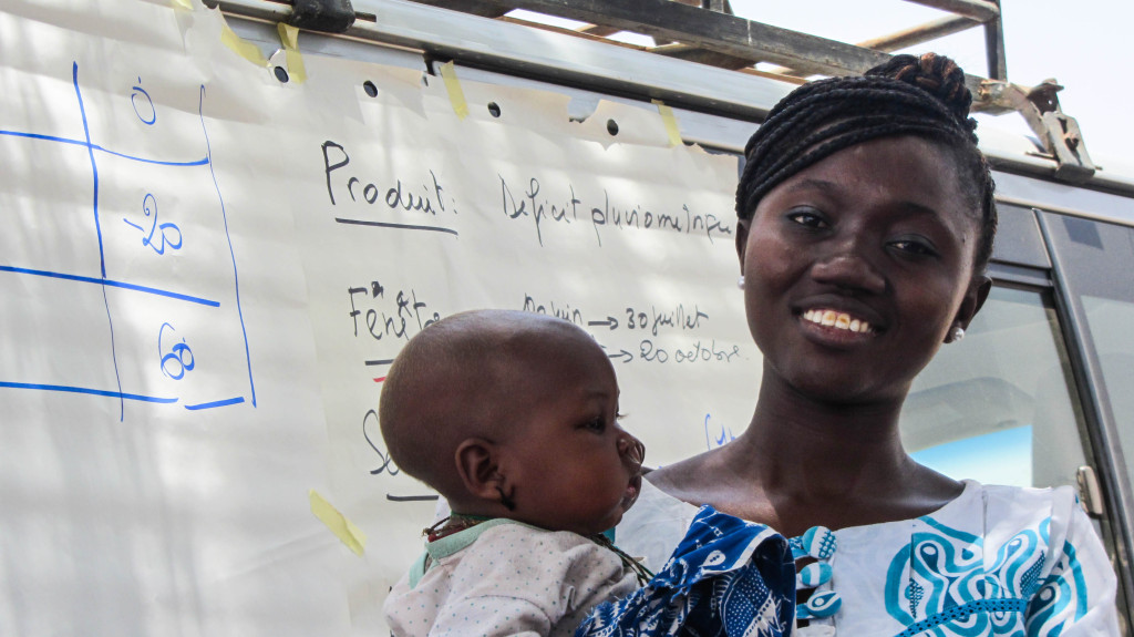
Florence Ndour, World Food Programme Officer, Senegal. Photo: Margot Le Guen/IRI
The Financial Instruments Sector Team at the IRI, lead by Dan Osgood, PhD, has played an integral role in index insurance projects across Africa with the help of its partners. This project is designed to take advantage of new partnerships with remote sensing scientists to ensure that the most appropriate products are being used on local and continent-wide scales.
“Satellites have an enormous amount of potential to help index insurance scale up across the developing world. They are far from being magic, but they aren’t garbage either. We’re doing the work to get the most out of the imagery, taking advantage of the strengths of each derived product,” said Osgood.
Financial tools for Climate Risk Adaptation
Droughts and high temperatures that come from climate variability have significant impacts on the agricultural sector. Both local and global impacts on food production will challenge the ability of many African countries to meet the need of their growing populations. The most vulnerable and food-insecure regions of the world need financial tools that not only will reduce the risk of food production shortages but also enable opportunities for increased productivity during times when growing conditions are optimal. Index-based weather insurance is a financial tool that can help enhance productivity for farmers by protecting them from risks they face during years with the worst growing conditions, providing a foundation for economic growth. Index insurance pays out based on an index, such as rainfall, measured at a local weather station or by satellite, rather than based on the consequences of weather, such as a farmer’s crop losses. In this way, index insurance becomes viable in regions characterized by low income, smallholder agriculture in a way that traditional insurance, which requires costly field visits to assess damage and determine premiums, is not. Having insurance allows farmers to apply for bank loans and other types of credit to obtain improved seeds, fertilizer and other agricultural inputs, which can boost production in good years. In order to create robust and accurate index insurance products, it is critical that we have reliable ways to measure or estimate crop growth and loss due to weather over large areas. This isn’t possible using only rain gauges and crop-yield data, but can be accomplished with expansive remotely-sensed datasets of environmental information.
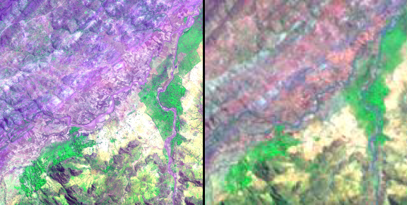
False color composites emphasize vegetation in bright green hues. Very high resolution image (left) from the GeoEye-1 commercial satellite and moderate resolution image (right) from NASA satellite Landsat TM were taken of Adi Ha village, Tigray, Ethiopia. Copyright 2011, DigitalGlobe (left image).
There are many types of satellite-derived products available, each with their own location-specific advantages and disadvantages. One of the aims of the project is to explore five different physical/environmental variables, including evapotranspiration, rainfall, soil moisture, vegetation and landscape characteristics. Using several different ways to measure drought or drought-like conditions is particularly important because drought may affect farmers differently depending on their location, the soil type of their fields and the crops they’ve planted. Using very high-resolution imagery with spatial resolution of a meter or less will help us identify boundaries between fields and to scale coarse-resolution drought information down to the village level. As another part of our project, our partners at the Michigan Tech Research Institute will also develop mobile, tablet, web and text messaging-based platforms to collect information from farmers, extension agents, economists and scientists in the field to inform remote sensing analyses and agricultural monitoring. Further details on the project available here.
You must be logged in to post a comment.