|
IRI Climate Digest
November 2005
Climate Impacts - October
Contributions to this page were made by IRI researchers
M. Bell,
Dr. A. Giannini,
E. Grover-Kopec,
Dr. B. Lyon,
C. Ropelewski
Africa
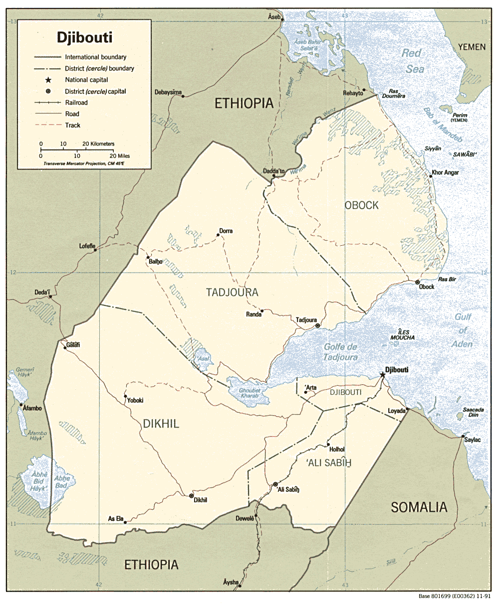
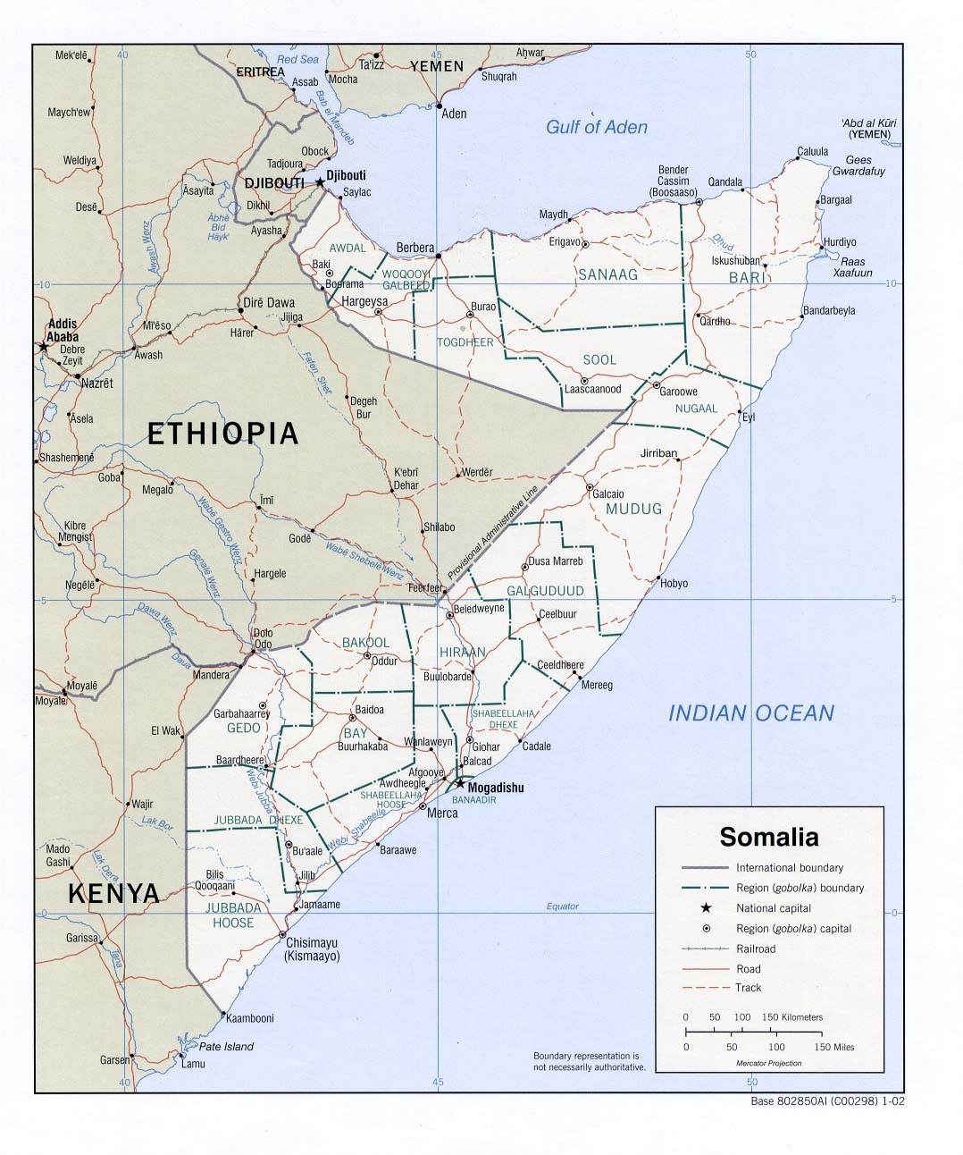
Agriculture - Djibouti,Somalia
Pasture conditions in Djibouti, which has recently been experiencing food insecurity, water shortages and large livestock losses after several years of below-normal precipitation, are not expected to significantly improve after the poor Karan rainy season (July-September WASP Index Map). What rain did fall improved the availability of water and pasture in most of the drought-hit areas, but those improvements are not expected to last through the dry season (October-February). The Karan rains were particularly poor in the southern grazing areas. Consequently, migration out of these areas to locations along the coast has started earlier than usual, coinciding with the arrival of the coastal Heys rains, which climatologically occur between October and February. Any improvements in food security in the north are expected to be short term, and the WFP will continue to provide food aid through January (March 2005 CID, FEWSNet).
Elsewhere in the Horn, Somalia is continuing to exhibit mixed levels of recovery from drought. Good Gu rains in the north, particularly in the Nugaal Valley and the Sool Plateau pastoral zones, have improved pasture and water conditions (April-June 2005 WASP Index Map). The southern areas, however, are still struggling to cope with drought conditions. The Deyr rainy season (Oct-Dec) started slowly last month with October rainfall that was well below normal (Oct 2005 Precipitation Percentile Map) (Sep 2005 CID, IRIN, FEWSNet).
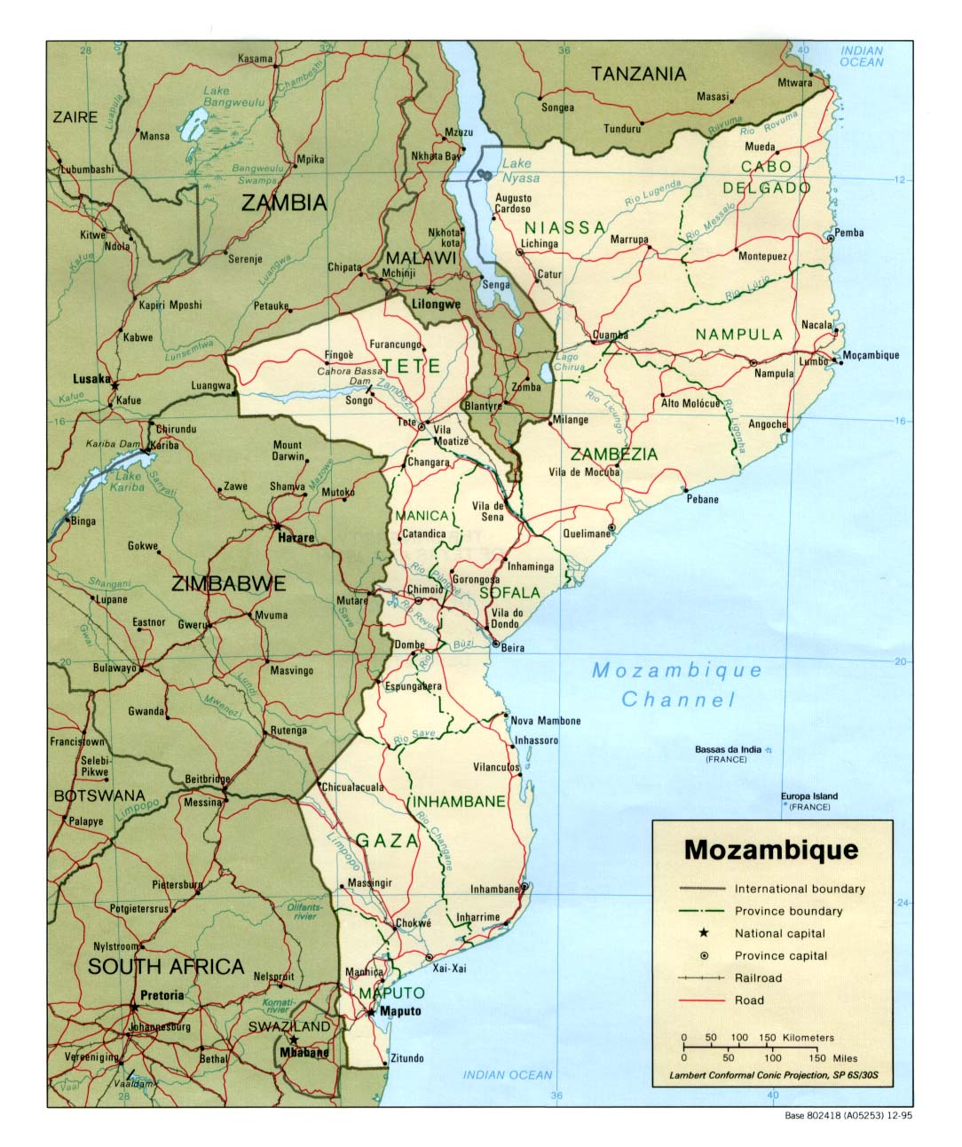
Agriculture - Mozambique
The number of people in Mozambique in need of food aid has doubled in the last six months, according to the Technical Secretariat for Food Security and Nutrition (SETSAN). Latest estimates indicate that more than 801,000 people in 62 districts will require food aid until March 2006. The failed crop from the last rainy season (Nov 2004-Apr 2005 WASP Index Map), which was partly to blame for the sharp increase in the number of those in need of assistance, came after what was the fourth year of drought in many areas. Approximately 43 percent of this year's maize production had been lost. Consequently, maize prices in some of the drought-hit areas have doubled since last year. Slow donor response is not helping matters either; the WFP is currently able to assist about 30 percent of those in need due to funding limitations. The central and southern provinces, including Gaza, Inhambane, Manica, Maputo, Sofala and Tete, have been worst hit by drought and its impacts. Officials are also concerned about the upcoming season because seeds for planting are "almost non-existent" in many areas (IRIN, FEWS Net, IRIN, IRIN).
The latest IRI seasonal forecast indicates a slightly-enhanced probability of below-normal precipitation during December-February 2006 for much of South Africa and surrounding areas, including a small part of southern Mozambique.
Asia
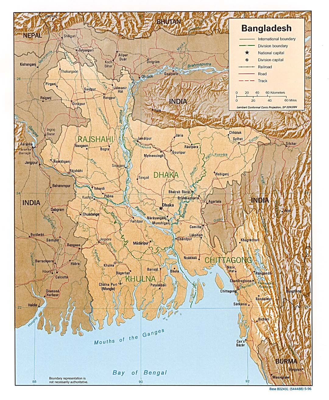
Hazards - Bangladesh
Heavy rains during the first half of October (Oct 2005 Precipitation Percentile Map) caused flooding in northern Bangladesh which killed 20 people and left about 500,000 homeless. At least 100,000 mud-walled homes were destroyed, and about 200,000 hectares of rice and vegetable crops were damaged (Reuters). The floods are also being blamed for 35 deaths from waterborne diarrheal infections, particularly in the Rangpur region of northern Bangladesh (DPA, ReliefWeb map).
The latest IRI seasonal precipitation forecast for December-February 2006 indicates a slightly-enhanced probability of below-normal precipitation for much of Bangladesh.
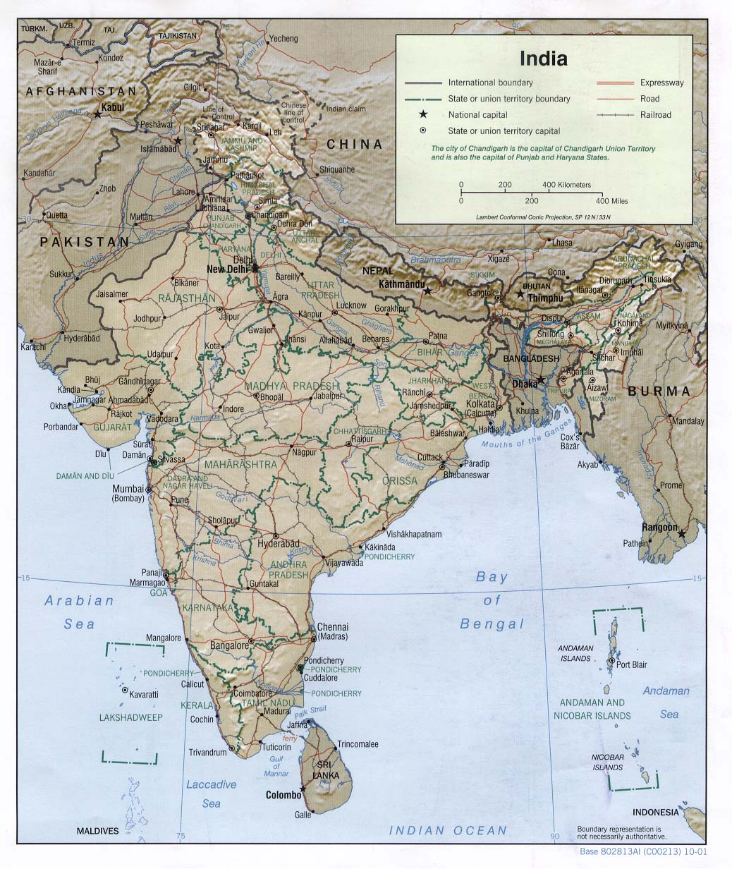
Hazards - India
After a rainy end in September (Oct 2005 CID) to what amounted to a near-normal southwest monsoon season in India, heavy rainfall ( Oct 2005 Precipitation Percentile Map), especially in the last half of October, produced flooding in eastern and southern India, while the rainy season ended on a dry note in the northwest, building upon the large deficits seen in August. Two tropical storms in the Bay of Bengal, 03B at the beginning of the month, and 04B at the end, contributed to the large October totals in the south and east (NCDC). Flooding in the state of West Bengal occurred after several days of heavy rainfall beginning on 18 October ( Estimated Precipitation Animation, ACT). As many as 3 million people were reportedly affected as rivers in the state flooded, causing crop damage, and damaging or destroying tens of thousands of homes (ACT). The East and West Midnapore districts, in which more than 200,000 people were made homeless, were characterized as the most affected in West Bengal.
Rains continued in much of southern and eastern India during the rest of the month, producing floods in the states of Tamil Nadu, Karnataka, and Andhra Pradesh (Reference Map, BBC, IFRC, BBC). At least 100 people in the three states were killed, and up to 77,000 people in Tamil Nadu were evacuated from their homes. Hundreds of villages were flooded, as were sections of the city of Bangalore. The latest IRI precipitation forecast for the December-February 2006 season indicates a slightly-enhanced probability of below-normal precipitation in sections of southern and eastern India.
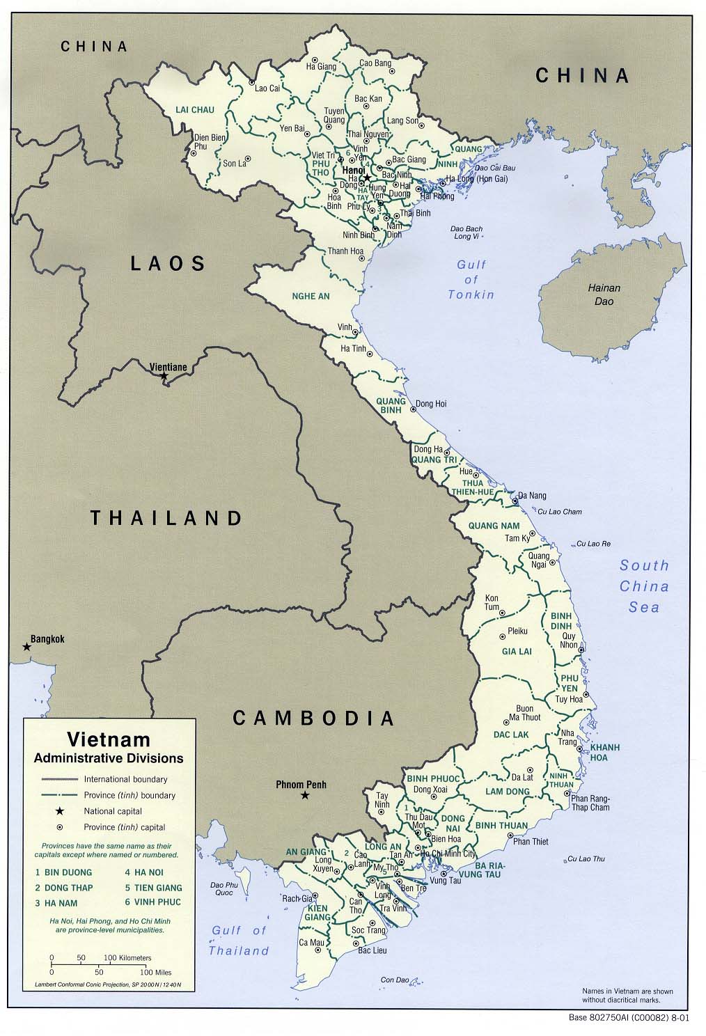
Hazards - Vietnam
Heavy rainfall during October in Vietnam was blamed for extending flood damage in the Mekong Delta as well as sparking new flooding in the central provinces of Binh Dinh, Quang Nai and Quang Nam (October 2005 WASP Index Map). In the delta province of Long An, dozens of deaths have been reported, but not yet confirmed. This comes after flooding forced as many as 100,000 people to evacuate in the same area during September (Oct 2005 CID). The worst hit areas in the central portion of the country were in Bin Dinh, where widespread flooding caused at least 67 deaths and damaged 3200 homes. Flood waters have reportedly started to recede in both areas, and farmers in the delta have been encouraged to clear rice fields as soon as possible to prepare for the winter-spring crop (OCHA, ReliefWeb Map).
The latest IRI seasonal precipitation forecast for December-February 2006 indicates a slightly-enhanced probability of below-normal rainfall in southern Vietnam and Cambodia.
Central America
Hazards - Caribbean,Central America,North America
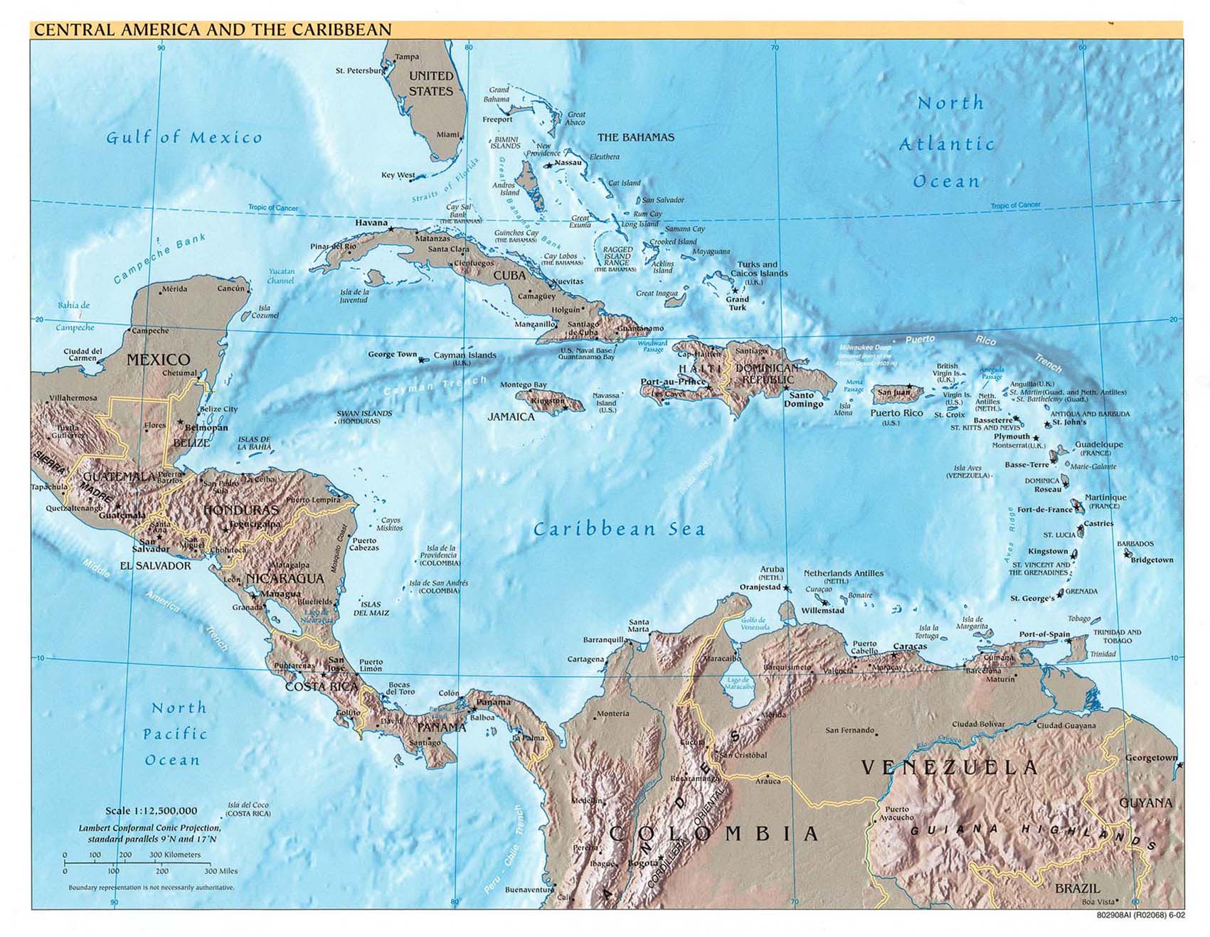
The 2005 Atlantic Hurricane season brought an unprecedented 23 named storms, including 13 hurricanes, that caused devastating losses across Central America, the Caribbean and the United States.
In Central America and the Caribbean region, most damage came from Hurricanes Dennis, Emily, Stan, Wilma and Beta. According to reports issued by national governments and OCHA, 812 people were killed in Guatemala (669), Mexico (22), El Salvador (68), Cuba (16) and Haiti (40), and more than 2 million people were affected across the region (USAID). Hurricane Stan had the broadest impact on the region. It affected eight countries in early October, with Guatemala being among the worst affected. According to the country's defense minister, one-third of Guatemalans were affected by the storm (AFP). Mudslides triggered by Stan's torrential rains buried the Mayan villages of Panabaj and Tzanchal, along with hundreds of their inhabitants. Officials were likely to leave parts of these villages as mass graves (Reuters). Agricultural losses were also severe, particularly for those who are dependent on terracing. According to FAO/GIEWS, most families in the departments of San Marcos, Sololá, Huehuetenango and Quetzaltenango lost most of their crops and 40-60 percent of their land to mudslides. WFP has issued an appeal to feed the approximately 285,000 people in Guatemala who will be in need of food aid by the end of the year. As of early November, the agency had received less than one-third of the requested USD 14.1 million.
Hurricanes Katrina, Rita and Wilma were just 3 of the 9 Atlantic storms to affect the United states during 2005 and were some of the most expensive storms on record. Rita and Wilma caused an estimated USD 4.7 and 7.2 billion in damage, respectively. They paled in comparison, however, to Hurricane Katrina, which struck the Gulf Coast in August and caused approximately USD 40 billion in damage. The storm killed at least 1300 people, mostly in the southern states of Louisiana and Mississippi, making it the deadliest hurricane to affect the United States since 1928. Approximately 275,000 homes were destroyed by Katrina, many of which were lost when New Orleans was flooded by Lake Pontchartrain. The fishing industry was particularly hard hit; the Louisiana Department of Wildlife and Fisheries estimate that 80 percent of this year's harvest and entire coastal fishing villages was lost in the storm (Insurance Information Institute, AFP).
Europe
Agriculture - Europe: Central,Europe: East,Europe: West
Portugal and Spain, which have suffered through months of drought, finally received some rainfall in October, the result of the unusual landfall of a tropical depression (the remnants of Hurricane Vince, NCDC). Although the rainfall arrived too late to help crops on the Iberian Peninsula, it could aid autumn planting (USDA). Dry conditions in October in Central and Eastern Europe (Oct 2005 Precipitation Anomaly Map) allowed for the late harvest of corn and sunflower crops, which had been delayed by rainy weather throughout the boreal summer. The dry weather has also aided winter grain planting in Hungary, Serbia, Croatia, and eastern Bosnia (Reference Map).
The latest IRI seasonal precipitation forecast for December-February 2006, which is within the rainy season for the Iberian Peninsula (Dec-Feb Climatological Percentage of Annual Precipitation), suggests a slightly-enhanced probability of below-normal precipitation in Portugal and sections of Spain.
North America
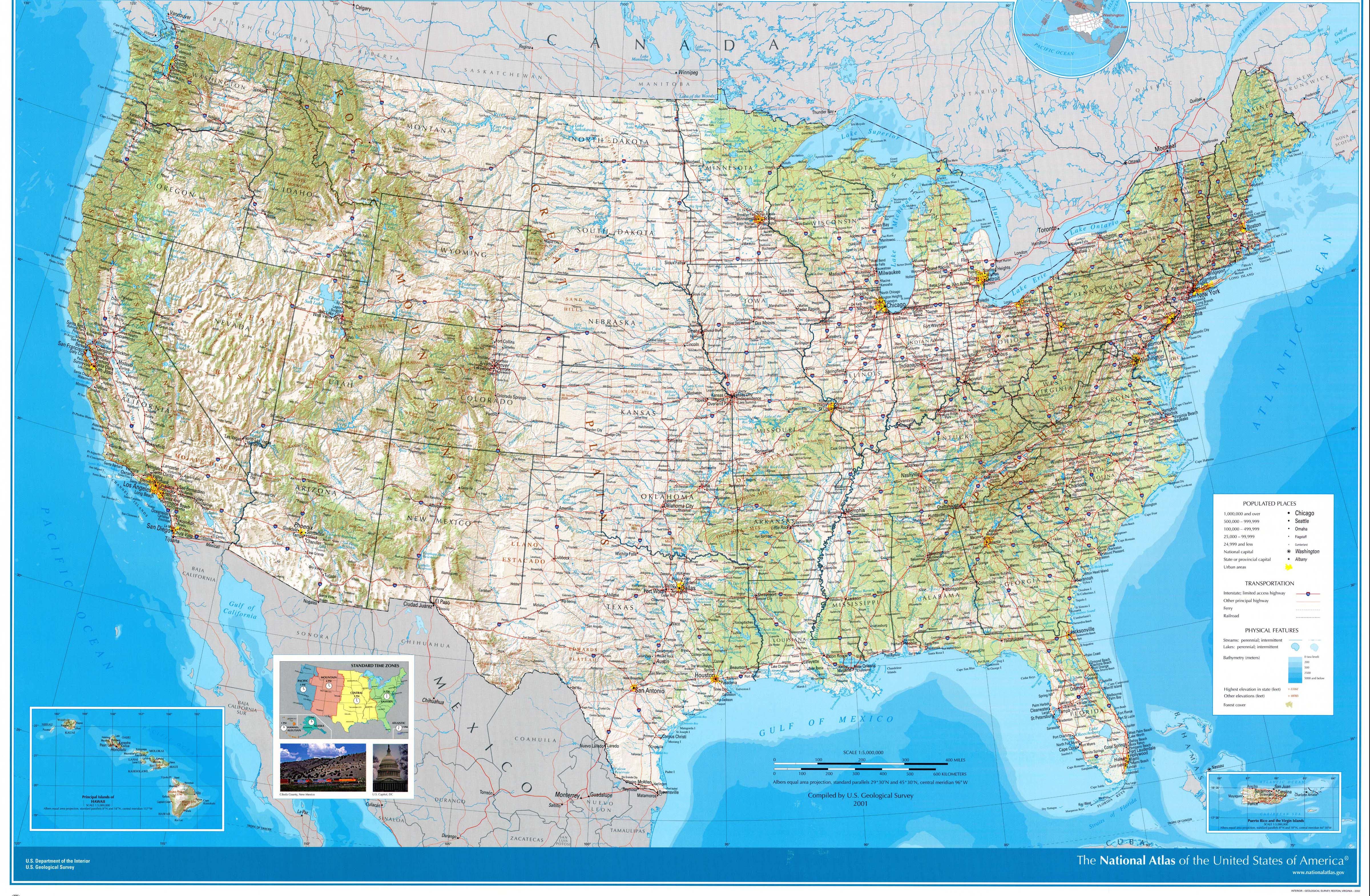
Hazards - United States
Days of continuous rainfall in the northeastern United States during the month of October (Oct 2005 1-Month WASP Index; Oct 2005 Precipitation Percentile Map) caused flooding and millions of dollars of damage to infrastructure, private property, and agriculture, and resulted in several deaths. A stalled front and steady stream of tropical moisture, followed by the remnants of Hurricane Wilma a few days later, contributed to record monthly rainfall totals in excess of 12 inches (30.5 centimeters) in several locations in New England and elsewhere in the Northeast (NCDC: Oct 2005 Precipitation Extremes; Oct 2005 Percent of Median Precipitation). As of 17 October, at least 12 weather-related deaths had been reported from an area stretching from Pennsylvania to Maine (AP). A few thousand people in the region were evacuated from their homes due to flooding or the threat of flooding, including more than 1000 people in New Hampshire and 2000 people in Taunton, Massachusetts, where a 173-year old dam threatened to break (CNN, AP). States of emergency were declared in five New England states (Bloomberg), where more than USD 27 million in damage was done by the storms. The poor weather may have been responsible for large declines in autumn tourism as well, which is an important industry in the region. There were also reports of agricultural losses of up to USD 6 million and severe coastal erosion on Long Island in New York state (New York Times).
South America
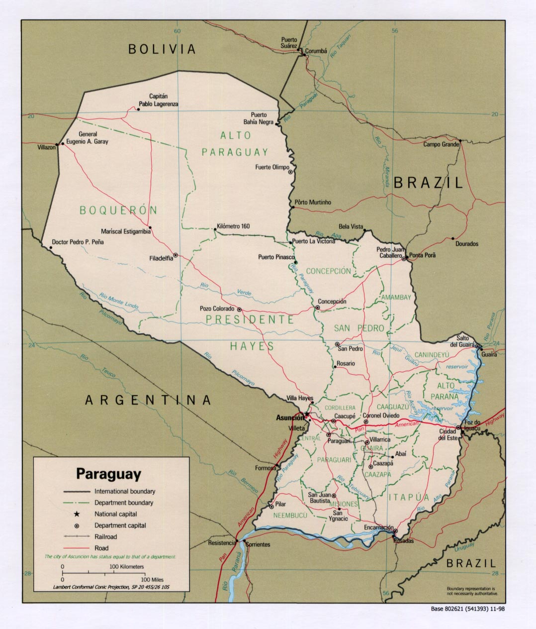
Water Resources - Paraguay
A national emergency was declared in late September for the Chaco region of Paraguay in response to a drought that is affecting more than 11,500 families. In all, nearly 53,000 people have been affected in 265 communities in the northwestern departments of Boquerón, Alto Paraguay and Presidente Hayes. Cisterns in the region have gone dry to lack of rain and water shortages are affecting the communities across the region, including Campo Loa, Casanillo, Laguna Negra and Santa Teresita. Lack of clean drinking water has reportedly been a factor in an increase in the occurrence of infectious diseases. While the region is largely populated by subsistence farmers, commercial farmers have also been hard hit, although estimates on the agricultural losses are not yet available. (IFRC, ReliefWeb Map, PAHO)
The Chaco Region has enjoyed a good start to their rainy season (Oct 2005 Wasp Index Map), which typically occurs October-April. The latest IRI seasonal forecast, however, indicates a slightly-enhanced probability of below-normal precipitation in the southern two-thirds of Paraguay for the upcoming December-February 2006 season.
Contents |
Special |
Impacts |
Climate |
Forecast
|
